IMAGES TAKEN NEAR TO
Mill Lane, EYE, IP21 5HW
Introduction
This page details the photographs taken nearby to Mill Lane, IP21 5HW by members of the Geograph project.
The Geograph project started in 2005 with the aim of publishing, organising and preserving representative images for every square kilometre of Great Britain, Ireland and the Isle of Man.

There are currently over 7.5m images from over14,400 individuals and you can help contribute to the project by visiting https://www.geograph.org.uk
Image Map
Images are licensed for reuse under creativecommons.org/licenses/by-sa/2.0
Notes
- Clicking on the map will re-center to the selected point.
- The higher the marker number, the further away the image location is from the centre of the postcode.
Image Listing (33 Images Found)
Images are licensed for reuse under creativecommons.org/licenses/by-sa/2.0
Image
Details
Distance
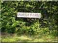
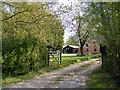
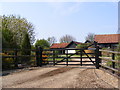
2
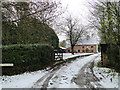
Entrance to Marsh Farm, Barley Green, Stradbroke
Image: © Adrian S Pye
Taken: 28 Nov 2010
0.04 miles
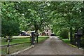
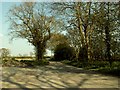
5
Mill Lane, Barley Green
At Marsh Farm entrance
Image: © Geographer
Taken: 7 May 2013
0.04 miles
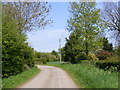
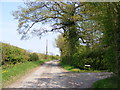
6
Mill Lane
This lane continues on to a farm called Brooklands and ends at that point.
Image: © Robert Edwards
Taken: 19 Apr 2007
0.07 miles
7
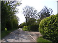
Mill Lane, Barley Green
Looking towards the B1117 Laxfield Road
Image: © Geographer
Taken: 7 May 2013
0.08 miles
9
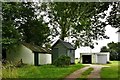
Pixey Green: Shed on wheels and other outbuildings
Image: © Michael Garlick
Taken: 18 Jul 2020
0.08 miles