
IMAGES TAKEN NEAR TO
Shingle Hill, EYE, IP21 5EU
Introduction
This page details the photographs taken nearby to Shingle Hill, IP21 5EU by members of the Geograph project.
The Geograph project started in 2005 with the aim of publishing, organising and preserving representative images for every square kilometre of Great Britain, Ireland and the Isle of Man.

There are currently over 7.5m images from over14,400 individuals and you can help contribute to the project by visiting https://www.geograph.org.uk
Image Map
Images are licensed for reuse under creativecommons.org/licenses/by-sa/2.0
Notes
- Clicking on the map will re-center to the selected point.
- The higher the marker number, the further away the image location is from the centre of the postcode.
Image Listing (62 Images Found)
Images are licensed for reuse under creativecommons.org/licenses/by-sa/2.0
Image
Details
Distance
1
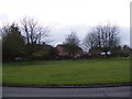
Houses at Shingle Hill Corner
Off the B1117 Cookley Road
Image: © Geographer
Taken: 21 Nov 2011
0.01 miles
2
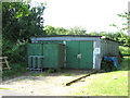
Former barrack hut
It is located on the former WAAF (Women's Auxiliary Air Force) site of RAF Horham which was an active airfield during WW2.
Image: © Evelyn Simak
Taken: 11 Jun 2015
0.02 miles
3
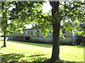
Former barrack hut
It is located on the former WAAF (Women's Auxiliary Air Force) site of RAF Horham which was an active airfield during WW2.
Image: © Evelyn Simak
Taken: 11 Jun 2015
0.03 miles
4
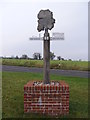
Denham Village Sign
On the B1117 Cookley Road at Shingle Hill Corner
Image: © Geographer
Taken: 21 Nov 2011
0.03 miles
5
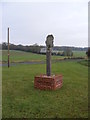
Denham Village Sign
On the B1117 Cookley Road at Shingle Hill Corner
Image: © Geographer
Taken: 21 Nov 2011
0.04 miles
6
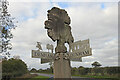
Denham village sign
Denham St. John the Baptist, not Denham St Mary. The sign has a seven elements, not all of which are obvious to the writer.
Surmounted by a representation of an oak tree, deer are a common sight in the parish, as are fruit orchards at Fruit Farm, chickens represent the poultry farm, and the church of St John, but a knight on a charger and a monk are perhaps a reference to Sir E. Kerrison, lord of the manor in the past and William de Kirsby, Kirkby or Kirby, (depending on the source) Prior of Norwich, in the 13th century.
https://www.geograph.org.uk/photo/6641027
Image: © Adrian S Pye
Taken: 16 Oct 2020
0.04 miles
7
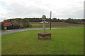
Denham village sign
Denham St. John the Baptist, not Denham St Mary. The sign has a seven elements, not all of which are obvious to the writer.
Surmounted by a representation of an oak tree, deer are a common sight in the parish, as are fruit orchards at Fruit Farm, chickens represent the poultry farm, and the church of St John, but a knight on a charger and a monk are perhaps a reference to Sir E. Kerrison, lord of the manor in the past and William de Kirsby, Kirkby or Kirby, (depending on the source) Prior of Norwich, in the 13th century.
https://www.geograph.org.uk/photo/6641029 https://www.geograph.org.uk/photo/6641028
Image: © Adrian S Pye
Taken: 16 Oct 2020
0.05 miles
8
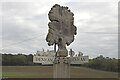
Denham village sign
Denham St. John the Baptist, not Denham St Mary. The sign has a seven elements, not all of which are obvious to the writer.
Surmounted by a representation of an oak tree, deer are a common sight in the parish, as are fruit orchards at Fruit Farm, chickens represent the poultry farm, and the church of St John, but a knight on a charger and a monk are perhaps a reference to Sir E. Kerrison, lord of the manor in the past and William de Kirsby, Kirkby or Kirby, (depending on the source) Prior of Norwich, in the 13th century.
https://www.geograph.org.uk/photo/6641027
Image: © Adrian S Pye
Taken: 16 Oct 2020
0.05 miles
9
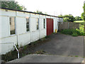
Former barrack hut
It is located on the former WAAF (Women's Auxiliary Air Force) site of RAF Horham which was an active airfield during WW2.
Image: © Evelyn Simak
Taken: 11 Jun 2015
0.05 miles
10
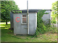
Former barrack hut
It is located on the former WAAF (Women's Auxiliary Air Force) site of RAF Horham which was an active airfield during WW2.
Image: © Evelyn Simak
Taken: 11 Jun 2015
0.05 miles