IMAGES TAKEN NEAR TO
Athelington Road, EYE, IP21 5EG
Introduction
This page details the photographs taken nearby to Athelington Road, IP21 5EG by members of the Geograph project.
The Geograph project started in 2005 with the aim of publishing, organising and preserving representative images for every square kilometre of Great Britain, Ireland and the Isle of Man.

There are currently over 7.5m images from over14,400 individuals and you can help contribute to the project by visiting https://www.geograph.org.uk
Image Map
Images are licensed for reuse under creativecommons.org/licenses/by-sa/2.0
Notes
- Clicking on the map will re-center to the selected point.
- The higher the marker number, the further away the image location is from the centre of the postcode.
Image Listing (14 Images Found)
Images are licensed for reuse under creativecommons.org/licenses/by-sa/2.0
Image
Details
Distance
1
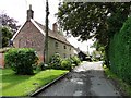
Pargetted cottage at Athelington
Pargetting is quite common in Essex but is Suffolk it is quite rare. Pargetting is created by moulds or stencils applied to the plaster while it is still wet.
Image: © Adrian S Pye
Taken: 30 Aug 2010
0.16 miles
2
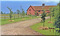
Horham: Rose Farm, near site of former station
View south-eastward: this was meant to be a photograph of the site of the former Horham station on the Mid-Suffolk Light Railway (Haughley - Laxfield), closed 28/7/52 and long disappeared into the farmland. The line had run very close to here (left towards Haughley), but the (primitive) station/halt had been a few hundred yards to the left.
Image: © Ben Brooksbank
Taken: 18 Jun 1997
0.18 miles
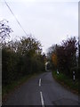
3
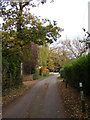
Horham Road, Athelington
Looking towards Worlingworth Road near the footpaths to Redlingfield and Worlingworth Roads.
Image: © Geographer
Taken: 17 Nov 2011
0.20 miles
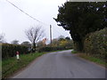
5
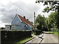
Athelington Road, Athelington
At the junction with Worlingworth Road
Image: © Geographer
Taken: 17 Nov 2011
0.24 miles
6
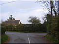
Athelington Road, Athelington
At the junction with Worlingworth Road
Image: © Geographer
Taken: 17 Nov 2011
0.24 miles
7
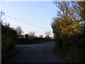
Worlingfield Road
At the junction with Horam Road
Image: © Geographer
Taken: 15 Nov 2011
0.24 miles
8
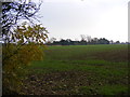
Footpath to Worlingworth Road
Off Horam Road
Image: © Geographer
Taken: 17 Nov 2011
0.24 miles
9
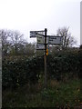
Roadsign on Worlingworth Road
At the junction with Horham Road
Image: © Geographer
Taken: 17 Nov 2011
0.24 miles
10
Worlingworth Road, Horham
At the junction with Horham Road
Image: © Geographer
Taken: 17 Nov 2011
0.24 miles