IMAGES TAKEN NEAR TO
Eye Road, EYE, IP21 5BA
Introduction
This page details the photographs taken nearby to Eye Road, IP21 5BA by members of the Geograph project.
The Geograph project started in 2005 with the aim of publishing, organising and preserving representative images for every square kilometre of Great Britain, Ireland and the Isle of Man.

There are currently over 7.5m images from over14,400 individuals and you can help contribute to the project by visiting https://www.geograph.org.uk
Image Map
Images are licensed for reuse under creativecommons.org/licenses/by-sa/2.0
Notes
- Clicking on the map will re-center to the selected point.
- The higher the marker number, the further away the image location is from the centre of the postcode.
Image Listing (10 Images Found)
Images are licensed for reuse under creativecommons.org/licenses/by-sa/2.0
Image
Details
Distance
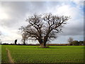
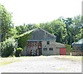
1
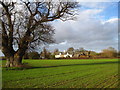
Fairstead Farm, Hoxne
The magnificent tree in the foreground is an ancient oak Image
Image: © Chris Holifield
Taken: 30 Dec 2012
0.01 miles
3
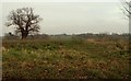
Footpath to Cross Street, just south of Hoxne
Image: © Robert Edwards
Taken: 19 Feb 2007
0.09 miles

5
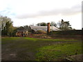
Banham's brickworks, Hoxne
Banhams' former brick works that once supplied bricks for the many houses and ornamental brick walls in the village. This is also the site where flint axes were first recognised as man-made by John Frere in 1791, made by early Paleolithic man 400,000 years ago. The fabulous Hoxne Hoard of Roman gold and silver coins, jewellery and many precious artefacts was also found close to here in 1992. http://www.manderton.co.uk/eadtwalk/hoxne.htm
Image: © Chris Holifield
Taken: 30 Dec 2012
0.11 miles
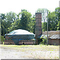
7
Banham's brickworks (disused)
The buildings formed part of the works which used to supply bricks for the construction of houses and ornamental brick walls in the surrounding villages. It is marked on the map as a depot and the site is currently advertised as for sale.
Image: © Evelyn Simak
Taken: 3 Jul 2015
0.11 miles
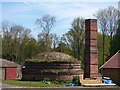
8
The former Banham's brickworks
The disused kiln formed part of the works which used to supply bricks for the construction of houses and ornamental brick walls in the surrounding villages. It is marked on the map as a depot and the site is currently advertised as for sale.
Image: © Evelyn Simak
Taken: 3 Jul 2015
0.11 miles
9
Banham's brickworks (disused)
The disused kiln formed part of the works which used to supply bricks for the construction of houses and ornamental brick walls in the surrounding villages. It is marked on the map as a depot and the site is currently advertised as for sale.
Image: © Evelyn Simak
Taken: 3 Jul 2015
0.11 miles
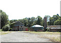
10
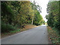
Country Lane
Country lane near to Hoxne, Suffolk.
Image: © Keith Evans
Taken: 18 Oct 2009
0.23 miles