1
St Mary Magdalene Church, Pulham Market, Norfolk - West doorway
Image: © John Salmon
Taken: 2 May 2008
0.04 miles
2
Cottages on Orchard Meadow
Pulham Market is an award winning conservation village in South Norfolk. It is built on high ground to the north of a small stream known as The Beck. Its origins date back at least to the 10th century, when the land belonged to Ethelwold, the Bishop of Winchester, who later gave it to the abbey of St Ethelred at Ely. By the 14th century the village had become sufficiently wealthy to build its own church, St Mary Magdalene > http://www.geograph.org.uk/photo/1594078. In Tudor times the village was famous for its cottage industries but when the market lost its appeal because of the larger one at Harleston many of the cottage industries were dispersed to other parts of Norfolk. The village boasts a number of old buildings > http://www.geograph.org.uk/photo/1594098 which are listed as being of architectural and historic interest. The green is surrounded by thatched cottages > http://www.geograph.org.uk/photo/1594055 as well as a general store and post office > http://www.geograph.org.uk/photo/1594035 and a pub on each end: The Falcon > http://www.geograph.org.uk/photo/1594037 in the north and the 17th century Crown at the other end, with the parish church towering over it > http://www.geograph.org.uk/photo/1594022. Until the 1950s the village was served by the Waveney Valley Railway line > http://www.geograph.org.uk/photo/1592892 which ran from the east coast to the main Norwich to London Line at Tivetshall. The line was closed in 1966.
Image: © Evelyn Simak
Taken: 23 Nov 2009
0.07 miles
3
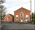
Pulham Market Methodist Church
Pulham Market Methodist Church, a recently extended 19th century red-brick building with adjoining meeting hall, situated at the junction of Colegate End and Tattlepot Roads.
Image: © Evelyn Simak
Taken: 23 Nov 2009
0.12 miles
4
Colegate End Road, Pulham Market
At the junction with Bank Street near Pulham Market Methodist Church
Image: © Geographer
Taken: 22 Nov 2014
0.13 miles
5
Pulham Market Methodist Church
On Colegate End Road at the junction with Bank Street
Image: © Geographer
Taken: 22 Nov 2014
0.13 miles
6
Methodist Church, Pulham Market
Image: © JThomas
Taken: 12 Oct 2016
0.13 miles
7
Colegate End Road Sign
On Colegate End Road at the junction with Bank Street near Pulham Market Methodist Church
Image: © Geographer
Taken: 22 Nov 2014
0.13 miles
8
Colegate End Road, Pulham Market
At the junction with Bank Street
Image: © Geographer
Taken: 22 Nov 2014
0.14 miles
9
Terraced cottages in Bank Street
Pulham Market is an award winning conservation village in South Norfolk. It is built on high ground to the north of a small stream known as The Beck. Its origins date back at least to the 10th century, when the land belonged to Ethelwold, the Bishop of Winchester, who later gave it to the abbey of St Ethelred at Ely. By the 14th century the village had become sufficiently wealthy to build its own church, St Mary Magdalene > http://www.geograph.org.uk/photo/1594078. In Tudor times the village was famous for its cottage industries but when the market lost its appeal because of the larger one at Harleston many of the cottage industries were dispersed to other parts of Norfolk. The village boasts a number of old buildings > http://www.geograph.org.uk/photo/1594098 which are listed as being of architectural and historic interest. The green is surrounded by thatched cottages > http://www.geograph.org.uk/photo/1594055 as well as a general store and post office > http://www.geograph.org.uk/photo/1594035 and a pub on each end: The Falcon > http://www.geograph.org.uk/photo/1594037 in the north and the 17th century Crown at the other end, with the parish church towering over it > http://www.geograph.org.uk/photo/1594022. Until the 1950s the village was served by the Waveney Valley Railway line > http://www.geograph.org.uk/photo/1592892 which ran from the east coast to the main Norwich to London Line at Tivetshall. The line was closed in 1966.
Image: © Evelyn Simak
Taken: 23 Nov 2009
0.15 miles
10
Entering Pulham Market
Heading south west on Colegate End Road.
Image: © JThomas
Taken: 12 Oct 2016
0.15 miles


