
IMAGES TAKEN NEAR TO
Norwich Road, DISS, IP21 4BB
Introduction
This page details the photographs taken nearby to Norwich Road, IP21 4BB by members of the Geograph project.
The Geograph project started in 2005 with the aim of publishing, organising and preserving representative images for every square kilometre of Great Britain, Ireland and the Isle of Man.

There are currently over 7.5m images from over14,400 individuals and you can help contribute to the project by visiting https://www.geograph.org.uk
Image Map
Images are licensed for reuse under creativecommons.org/licenses/by-sa/2.0
Notes
- Clicking on the map will re-center to the selected point.
- The higher the marker number, the further away the image location is from the centre of the postcode.
Image Listing (11 Images Found)
Images are licensed for reuse under creativecommons.org/licenses/by-sa/2.0
Image
Details
Distance
3
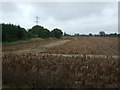
Crop field and hedgerow off the A140
A potato crop field ready for harvest.
Image: © JThomas
Taken: 15 Sep 2015
0.07 miles
4
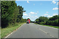
Northbound A140
The Routemaster bus ahead was on wedding duty.
Image: © Robin Webster
Taken: 11 Aug 2018
0.07 miles
5
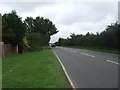
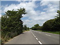
Heading north east on the A140
Towards Norwich.
Image: © JThomas
Taken: 15 Sep 2015
0.08 miles
6
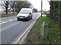
To Norwich 21
Old milestone on the A.140 at Brome, Suffolk. For close up view see http://www.geograph.org.uk/photo/1207471 For more info about the stone see http://milestones.megalithia.com/sites/tm136770.htm and do have a look at their home page. This one of a series of mileposts that follow the A.140 see http://www.geograph.org.uk/search.php?i=9240043&displayclass=full
Image: © Keith Evans
Taken: 17 Mar 2009
0.14 miles
8
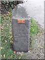
Old Milestone
Old milestone on the A.140 at Brome, Suffolk. For overall view see http://www.geograph.org.uk/photo/1207468 For more info on the stone see http://milestones.megalithia.com/sites/tm136770.htm and do have a look at their home page. This one of a series of mileposts that follow the A.140 see http://www.geograph.org.uk/search.php?i=9240043&displayclass=full
Image: © Keith Evans
Taken: 17 Mar 2009
0.18 miles
10

Helicopter hovering over electricity line
It remained there for at least 30 minutes. The black camera ball just under the nose of the craft indicates that this is a service helicopter. They fly along the wires and pause to film the wires and pylons. Occasionally one can see the service man or woman in their wire mesh suit touching a pole to the wire in order to neutralize the static electricity and then hop on the wire to carry out some maintenance work. For a zoomed-in view see > http://www.geograph.org.uk/photo/4508673.
Image: © Evelyn Simak
Taken: 4 Jun 2015
0.23 miles