IMAGES TAKEN NEAR TO
The Common, DISS, IP21 4AA
Introduction
This page details the photographs taken nearby to The Common, IP21 4AA by members of the Geograph project.
The Geograph project started in 2005 with the aim of publishing, organising and preserving representative images for every square kilometre of Great Britain, Ireland and the Isle of Man.

There are currently over 7.5m images from over14,400 individuals and you can help contribute to the project by visiting https://www.geograph.org.uk
Image Map
Images are licensed for reuse under creativecommons.org/licenses/by-sa/2.0
Notes
- Clicking on the map will re-center to the selected point.
- The higher the marker number, the further away the image location is from the centre of the postcode.
Image Listing (46 Images Found)
Images are licensed for reuse under creativecommons.org/licenses/by-sa/2.0
Image
Details
Distance
3
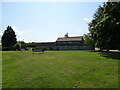
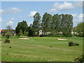
Diss Golf Club
Off the B1077 Stuston Road
http://www.dissgolf.co.uk/
Image: © Geographer
Taken: 11 Nov 2014
0.03 miles
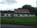
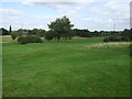
4
Diss Golf Club Stuston Common, Diss
Off the B1077 Struston Road
http://www.dissgolf.co.uk/
Image: © Geographer
Taken: 2 Apr 2014
0.03 miles
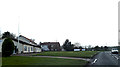
6
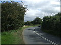
Entering Stuston
Heading south east on Stuston Road (B1077).
Image: © JThomas
Taken: 15 Sep 2015
0.11 miles
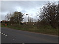
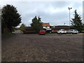
9
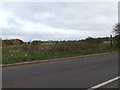
Footpath to the B1077 Stuston Road
Off the B1077 Stuston Road
Image: © Geographer
Taken: 11 Nov 2014
0.11 miles
10
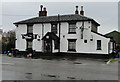
The White Elephant public house at Diss
Image: © Adrian S Pye
Taken: 17 Jan 2011
0.12 miles