IMAGES TAKEN NEAR TO
Swallow Road, IPSWICH, IP2 0TT
Introduction
This page details the photographs taken nearby to Swallow Road, IP2 0TT by members of the Geograph project.
The Geograph project started in 2005 with the aim of publishing, organising and preserving representative images for every square kilometre of Great Britain, Ireland and the Isle of Man.

There are currently over 7.5m images from over14,400 individuals and you can help contribute to the project by visiting https://www.geograph.org.uk
Image Map
Images are licensed for reuse under creativecommons.org/licenses/by-sa/2.0
Notes
- Clicking on the map will re-center to the selected point.
- The higher the marker number, the further away the image location is from the centre of the postcode.
Image Listing (33 Images Found)
Images are licensed for reuse under creativecommons.org/licenses/by-sa/2.0
Image
Details
Distance
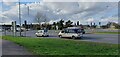
1
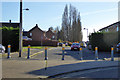
Sprite's Lane
Blocked off as a through route consequent to the large scale housing developments here, and the associated new roads.
Image: © Robin Webster
Taken: 19 Nov 2017
0.09 miles
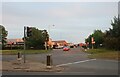
4
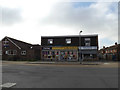
Shops on Greenfinch Avenue
At the junction with Robin Drive
Image: © Geographer
Taken: 26 Oct 2015
0.12 miles
5
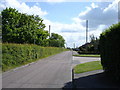
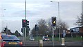
London Road
The main A-road is just over the hedge to the left of this photo.
Image: © Oxymoron
Taken: 18 May 2009
0.12 miles
7
Scrivener Drive from London Road Ipswich
Image: © David Howard
Taken: 22 May 2022
0.14 miles
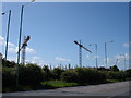
10
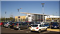
Suffolk One
This is a Further Education College for 16-19 year olds http://www.suffolkone.org/
Image: © Chris Holifield
Taken: 8 Apr 2011
0.16 miles