IMAGES TAKEN NEAR TO
Teal Close, IPSWICH, IP2 0TH
Introduction
This page details the photographs taken nearby to Teal Close, IP2 0TH by members of the Geograph project.
The Geograph project started in 2005 with the aim of publishing, organising and preserving representative images for every square kilometre of Great Britain, Ireland and the Isle of Man.

There are currently over 7.5m images from over14,400 individuals and you can help contribute to the project by visiting https://www.geograph.org.uk
Image Map
Images are licensed for reuse under creativecommons.org/licenses/by-sa/2.0
Notes
- Clicking on the map will re-center to the selected point.
- The higher the marker number, the further away the image location is from the centre of the postcode.
Image Listing (22 Images Found)
Images are licensed for reuse under creativecommons.org/licenses/by-sa/2.0
Image
Details
Distance
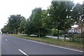
8
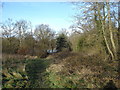
Chantry park, with the lake just visible through the trees
Image: © Oxymoron
Taken: 11 Jan 2009
0.17 miles
10
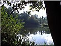
Hidden Cast
Fishing Pond Chantry Park Ipswich
Image: © Eric Woodhouse
Taken: 3 Oct 2005
0.21 miles