IMAGES TAKEN NEAR TO
St. Marys Close, HARLESTON, IP20 9HS
Introduction
This page details the photographs taken nearby to St. Marys Close, IP20 9HS by members of the Geograph project.
The Geograph project started in 2005 with the aim of publishing, organising and preserving representative images for every square kilometre of Great Britain, Ireland and the Isle of Man.

There are currently over 7.5m images from over14,400 individuals and you can help contribute to the project by visiting https://www.geograph.org.uk
Image Map
Images are licensed for reuse under creativecommons.org/licenses/by-sa/2.0
Notes
- Clicking on the map will re-center to the selected point.
- The higher the marker number, the further away the image location is from the centre of the postcode.
Image Listing (49 Images Found)
Images are licensed for reuse under creativecommons.org/licenses/by-sa/2.0
Image
Details
Distance
1
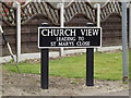
Church View sign
On Church View at the junction with School Lane
Image: © Geographer
Taken: 24 Mar 2015
0.11 miles
2
Church View, Harleston
At the junction with School Lane
Image: © Geographer
Taken: 24 Mar 2015
0.12 miles
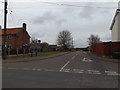
3
School Lane, Harleston
At the junction with Church View
Image: © Geographer
Taken: 24 Mar 2015
0.12 miles
4
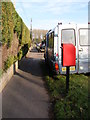
The Thoroughfare Postbox
Postbox No.IP20 7011
Image: © Geographer
Taken: 17 Jan 2012
0.13 miles
5
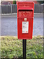
The Thoroughfare Postbox
Postbox No.IP20 7011
Image: © Geographer
Taken: 17 Jan 2012
0.13 miles
7
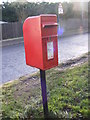
The Thoroughfare Postbox
Postbox No.IP20 7011
Image: © Geographer
Taken: 17 Jan 2012
0.13 miles
8
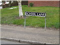
School Lane sign
On School Lane at the junction with Redenhall Road
Image: © Geographer
Taken: 24 Mar 2015
0.14 miles
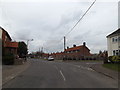
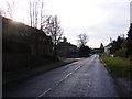
9
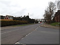
Redenhall Road, Harleston
At the junction with School Lane
Road No.C571
Image: © Geographer
Taken: 24 Mar 2015
0.14 miles
10
Site of the former Redenhall Road girder bridge at Harleston
The bridge, just a few yards from Harleston Station, (designated No.1179) was a girder bridge on brick abutments, crossed the road diagonally where a house has since been erected on one side of the road and two bungalows on the other.
Image: © Adrian S Pye
Taken: 29 Nov 2022
0.15 miles