
IMAGES TAKEN NEAR TO
Candlers Lane, IP20 9FL
Introduction
This page details the photographs taken nearby to Candlers Lane, IP20 9FL by members of the Geograph project.
The Geograph project started in 2005 with the aim of publishing, organising and preserving representative images for every square kilometre of Great Britain, Ireland and the Isle of Man.

There are currently over 7.5m images from over14,400 individuals and you can help contribute to the project by visiting https://www.geograph.org.uk
Image Map
Images are licensed for reuse under creativecommons.org/licenses/by-sa/2.0
Notes
- Clicking on the map will re-center to the selected point.
- The higher the marker number, the further away the image location is from the centre of the postcode.
Image Listing (160 Images Found)
Images are licensed for reuse under creativecommons.org/licenses/by-sa/2.0
Image
Details
Distance
1
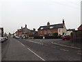
The Thoroughfare, Harleston
At the junction with Station Road
Image: © Geographer
Taken: 17 Mar 2015
0.06 miles
2
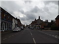
The Thoroughfare, Harleston
At the junction with Station Road
Image: © Geographer
Taken: 24 Mar 2015
0.06 miles
3
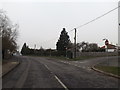
The Thoroughfare, Harleston
At the junction with Station Road
Image: © Geographer
Taken: 17 Mar 2015
0.06 miles
4
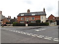
Millhouse Pottery
On Station Road at the junction with The Thoroughfare
http://www.studiopottery.com/cgi-bin/mp.cgi?item=330
http://www.studiopottery.com/cgi-bin/mp.cgi?item=329
Image: © Geographer
Taken: 24 Mar 2015
0.07 miles
5
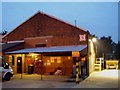
Harleston station Goods shed
The former goods shed at Harleston, the station site is now home to Blackburn Construction, the station was the only one of the former Waveney Valley Railway to have a footbridge.
Image: © Ashley Dace
Taken: 3 Mar 2008
0.07 miles
6
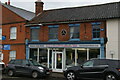
Former bicycle shop, Redenhall Road, Harleston
The roundel on the first floor is that of the Cyclists' Touring Club. In the late 19th and early 20th century the CTC used these to indicate premises that were welcoming to "wheelmen": in general these were pubs and hotels, but in this case there is a small curved bar around the top of the standard logo in which the text "Repairer to" indicates that this housed a cycle workshop.
Image: © Christopher Hilton
Taken: 5 Nov 2022
0.07 miles
7
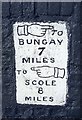
Old Milestone by the B1134, Redenhall Road, Harleston
Carved stone post by the B1134 (was A143), in parish of Redenhall with Harleston (South Norfolk District), Redenhall Road, Harleston, by No. 23, in wall, on North side of road. Erected by an unknown authority in the 19th century.
Inscription reads:-
{hand->} TO
BUNGAY
7
MILES
TO {<-hand}
SCOLE
6
MILES
Norfolk HER.
NHER Number: 57228 https://www.heritagegateway.org.uk/Gateway/Results_Single.aspx?uid=MNF63518&resourceID=1002
Milestone Society National ID: NO_ScHa8
Image: © CW Haines
Taken: 30 Oct 2013
0.09 miles
8
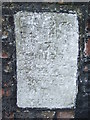
To Bungay 8
Old milepost on what was the old A143 at Harleston, Norfolk. For overall view see http://www.geograph.org.uk/photo/1448120 and for more info on the post see http://milestones.megalithia.com/sites/tm247838.htm do have a look at their home page.
Image: © Keith Evans
Taken: 18 Aug 2009
0.09 miles
9
Former butcher's shop, Redenhall Road, Harleston
This former butcher's shop is now a pizza takeaway. Tiles below the window give its former telephone number, Harleston 38.
Image: © Christopher Hilton
Taken: 5 Nov 2022
0.09 miles
10
Station Hill, Harleston
Near the former Harleston Railway Station
Road No.C363
Image: © Geographer
Taken: 24 Mar 2015
0.10 miles