
IMAGES TAKEN NEAR TO
Love Lane, HARLESTON, IP20 9DA
Introduction
This page details the photographs taken nearby to Love Lane, IP20 9DA by members of the Geograph project.
The Geograph project started in 2005 with the aim of publishing, organising and preserving representative images for every square kilometre of Great Britain, Ireland and the Isle of Man.

There are currently over 7.5m images from over14,400 individuals and you can help contribute to the project by visiting https://www.geograph.org.uk
Image Map
Images are licensed for reuse under creativecommons.org/licenses/by-sa/2.0
Notes
- Clicking on the map will re-center to the selected point.
- The higher the marker number, the further away the image location is from the centre of the postcode.
Image Listing (165 Images Found)
Images are licensed for reuse under creativecommons.org/licenses/by-sa/2.0
Image
Details
Distance
1
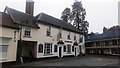
J D Young Hotel, Exchange Street
Housed in a former coaching inn, dating back to the 15th century.
Image: © Stuart Shepherd
Taken: 10 Mar 2018
0.02 miles
3
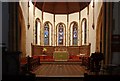
St John the Baptist, Harleston, Norfolk - Chancel
Image: © John Salmon
Taken: 26 Oct 2009
0.06 miles
4

St John the Baptist's church in Harleston - stained glass
Stained glass window by WG Taylor of London, 1884.
St John the Baptist's church > http://www.geograph.org.uk/photo/2029351 was built in the 1870s by diocesan architect Richard Phipson, replacing a ruinous medieval church on the market place. The church has a number of noteworthy stained glass windows > http://www.geograph.org.uk/photo/2029368 - http://www.geograph.org.uk/photo/2029362. Paul Quail designed the modern windows > http://www.geograph.org.uk/photo/2029371 in the Lady Chapel which was dedicated in 1986.
Image: © Evelyn Simak
Taken: 23 Aug 2010
0.08 miles
5
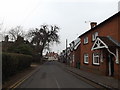
Mendham Lane, Harleston
Approaching the junction with Church & Broad Street
Image: © Geographer
Taken: 17 Mar 2015
0.08 miles
7
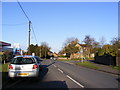
London Road, Harleston
At the junction with Willow Walk
Image: © Geographer
Taken: 9 Dec 2011
0.10 miles
8
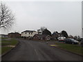
Mendham Lane, Harleston
At the junction with Lime Close
Image: © Geographer
Taken: 17 Mar 2015
0.10 miles
9
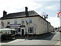
The Magpie public house and restaurant at Harleston
https://www.geograph.org.uk/photo/6131547
Image: © Adrian S Pye
Taken: 24 Apr 2019
0.10 miles
10
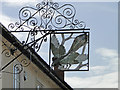
The sign of the Magpie at Harleston
https://www.geograph.org.uk/photo/6131541
Image: © Adrian S Pye
Taken: 24 Apr 2019
0.10 miles