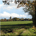
IMAGES TAKEN NEAR TO
The Street, HARLESTON, IP20 0DN

Introduction

This page details the photographs taken nearby to The Street, IP20 0DN by members of the Geograph project.

The Geograph project started in 2005 with the aim of publishing, organising and preserving representative images for every square kilometre of Great Britain, Ireland and the Isle of Man.

There are currently over 7.5m images from over14,400 individuals and you can help contribute to the project by visiting https://www.geograph.org.uk

Image Map


Images are licensed for reuse under creativecommons.org/licenses/by-sa/2.0
Notes
  • Clicking on the map will re-center to the selected point.
  • The higher the marker number, the further away the image location is from the centre of the postcode.

Image Listing (25 Images Found)

Images are licensed for reuse under creativecommons.org/licenses/by-sa/2.0
  • ...
Image
Details
Distance
1
The Street in Alburgh
Image: © Evelyn Simak Taken: 7 Nov 2010
0.05 miles
2
Cottages in The Street, Alburgh
Image: © Evelyn Simak Taken: 7 Nov 2010
0.07 miles
3
Stile and Moat at Moat Farm
Image: © Ian Robertson Taken: 18 Mar 2007
0.13 miles
4
Public footpath west of Payne's Hill
The path turns off Payne's Hill, forking several times and diverging into various direction. Followed in westerly direction it leads to The Street in Alburgh, followed in the view direction it leads back to Payne's Hill further to the south-east.
Image: © Evelyn Simak Taken: 7 Nov 2010
0.16 miles
5
Plank bridge over a ditch
This public footpath turns off Payne's Hill, forking several times and diverging into various direction. Followed in westerly direction it leads to The Street in Alburgh.
Image: © Evelyn Simak Taken: 7 Nov 2010
0.16 miles
6
The Old Post Office, Alburgh
A sign on the small brick building at left marks it as The Old Post Office. A K6 telephone box can be seen in front of it.
Image: © Evelyn Simak Taken: 7 Nov 2010
0.17 miles
7
Entrance to Moat Farm, Alburgh
Image: © Evelyn Simak Taken: 7 Nov 2010
0.18 miles
8
Church Road, Alburgh
About to join The Street on the right and Low Road on the left.
Image: © Adrian S Pye Taken: 4 Dec 2010
0.19 miles
9
Autumnal tree beside the footpath
The path turns off Payne's Hill, forking several times and diverging into various direction. Followed in westerly direction it leads to The Street in Alburgh.
Image: © Evelyn Simak Taken: 7 Nov 2010
0.19 miles
10
Cultivated field east of Payne's Hill, Alburgh
The tower of All Saints' church > http://www.geograph.org.uk/photo/1770481 can be seen in the background (in adjacent square).
Image: © Evelyn Simak Taken: 7 Nov 2010
0.19 miles
  • ...