IMAGES TAKEN NEAR TO
High Road, HARLESTON, IP20 0AG

Introduction

This page details the photographs taken nearby to High Road, IP20 0AG by members of the Geograph project.

The Geograph project started in 2005 with the aim of publishing, organising and preserving representative images for every square kilometre of Great Britain, Ireland and the Isle of Man.

There are currently over 7.5m images from over14,400 individuals and you can help contribute to the project by visiting https://www.geograph.org.uk

Image Map


Images are licensed for reuse under creativecommons.org/licenses/by-sa/2.0
Notes
  • Clicking on the map will re-center to the selected point.
  • The higher the marker number, the further away the image location is from the centre of the postcode.

Image Listing (20 Images Found)

Images are licensed for reuse under creativecommons.org/licenses/by-sa/2.0
Image
Details
Distance
1
The road into Wortwell village
Image: © Robert Edwards Taken: 8 Mar 2007
0.02 miles
2
High Road, Wortwell
Looking towards Redenhall at the junction Windmill Road
Image: © Geographer Taken: 26 Jan 2009
0.14 miles
3
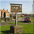
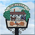
Wortwell village sign
The sign show The Bell Inn, the 17th century coaching inn with a coach waiting while the ostler changes the horses. In the background is High Road.
Image: © Adrian S Pye Taken: 16 Dec 2010
0.14 miles
4
High Road, Wortwell
Looking towards the B1062 at the junction Windmill Road
Image: © Geographer Taken: 26 Jan 2009
0.14 miles
5
Wortwell village sign
The sign show The Bell Inn, the 17th century coaching inn with a coach from which passengers are alighting. The cock pheasant and ears of wheat reflect the parish's agricultural nature and surroundings. https://www.geograph.org.uk/photo/6744683
Image: © Adrian S Pye Taken: 2 Feb 2021
0.15 miles
6
Wortwell Village Sign
On High Road at the junction Windmill Road It appears to be temporarily removed
Image: © Geographer Taken: 26 Jan 2009
0.15 miles
7
Children's Play Area at Wortwell Community Centre
Image: © Geographer Taken: 21 Apr 2015
0.15 miles
8
Wortwell Village sign
On High Road at the junction with Windmill Road (Close up)
Image: © Geographer Taken: 27 Sep 2014
0.15 miles
9
Wortwell Village sign
On High Road at the junction with Windmill Road
Image: © Geographer Taken: 27 Sep 2014
0.15 miles
10
High Road & Wortwell Village sign
At the junction with Windmill Road Road No.C571
Image: © Geographer Taken: 27 Sep 2014
0.15 miles