
IMAGES TAKEN NEAR TO
Church Lane, HALESWORTH, IP19 9LP
Introduction
This page details the photographs taken nearby to Church Lane, IP19 9LP by members of the Geograph project.
The Geograph project started in 2005 with the aim of publishing, organising and preserving representative images for every square kilometre of Great Britain, Ireland and the Isle of Man.

There are currently over 7.5m images from over14,400 individuals and you can help contribute to the project by visiting https://www.geograph.org.uk
Image Map
Images are licensed for reuse under creativecommons.org/licenses/by-sa/2.0
Notes
- Clicking on the map will re-center to the selected point.
- The higher the marker number, the further away the image location is from the centre of the postcode.
Image Listing (345 Images Found)
Images are licensed for reuse under creativecommons.org/licenses/by-sa/2.0
Image
Details
Distance
1
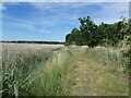
Railway path beside the Blythburgh Marshes
The Southwold Railway was a narrow (3-foot) gauge line from Halesworth to Southwold which operated from 1879 to 1929. Although not formally designated as a railway path or public right of way, there are several parts of the line which can be followed on foot.
Image: © Oliver Dixon
Taken: 21 Jun 2022
0.02 miles
2
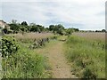
Railway path beside the Blythburgh Marshes
The Southwold Railway was a narrow (3-foot) gauge line from Halesworth to Southwold which operated from 1879 to 1929. Although not formally designated as a railway path or public right of way, there are several parts of the line which can be followed on foot.
Image: © Oliver Dixon
Taken: 21 Jun 2022
0.04 miles
3
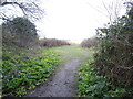
Heading out of Blythburgh into open country
Image: © Adrian S Pye
Taken: 6 Jan 2023
0.06 miles
4
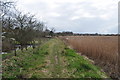
Small Ex Railway Embankment
This is the slightly raised path of the Southwold Railway embankment. The 3 ft narrow gauge line opened in 1879 after local people set up their own company to built it. Firstly being successful trade declined after the first war war when the fishing industry collapsed. Also the Southwold omnibus was allowed to stop at Southwold taking trade. The buses could travel much faster than the maximum 16mph speed limit.
Closure came in 1929 with trade salvage in the second world war.
Image: © Ashley Dace
Taken: 27 Mar 2010
0.06 miles
5
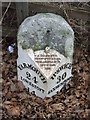
To London 99
Old cast iron milepost Blythburgh, Suffolk. For overall view see http://www.geograph.org.uk/photo/1175875 For more info see http://milestones.megalithia.com/sites/tm450752.htm and don't miss their home page. This is one of a series of mileposts that follow the A12 see http://www.geograph.org.uk/search.php?i=5288637
Image: © Keith Evans
Taken: 23 Feb 2009
0.07 miles
6
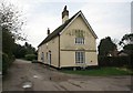
Cottage by Church lane
Interesting Suffolk cottage by Church lane
Image: © roger geach
Taken: 3 Oct 2010
0.07 miles
7
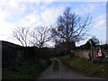
Church Lane, Blythburgh & Footpath to the A12 London Road
Image: © Geographer
Taken: 14 Jan 2012
0.07 miles
8
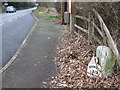
Old Cast Iron Milepost
Old cast iron Blythburgh, Ipswich, Suffolk. For close up view see http://www.geograph.org.uk/photo/1175870 for more info on the post see http://milestones.megalithia.com/sites/tm450752.htm do look at their home page.
Image: © Keith Evans
Taken: 23 Feb 2009
0.08 miles
9
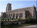
Holy Trinity, Blythburgh
Known as the 'Cathedral of the Marshes'.
Image: © mym
Taken: 19 Apr 2003
0.08 miles
10
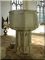
Font in Holy Trinity Church, Blythburgh
Image: © Peter Beaven
Taken: 26 Sep 2006
0.08 miles