
IMAGES TAKEN NEAR TO
Blyford Road, HALESWORTH, IP19 9JP
Introduction
This page details the photographs taken nearby to Blyford Road, IP19 9JP by members of the Geograph project.
The Geograph project started in 2005 with the aim of publishing, organising and preserving representative images for every square kilometre of Great Britain, Ireland and the Isle of Man.

There are currently over 7.5m images from over14,400 individuals and you can help contribute to the project by visiting https://www.geograph.org.uk
Image Map
Images are licensed for reuse under creativecommons.org/licenses/by-sa/2.0
Notes
- Clicking on the map will re-center to the selected point.
- The higher the marker number, the further away the image location is from the centre of the postcode.
Image Listing (33 Images Found)
Images are licensed for reuse under creativecommons.org/licenses/by-sa/2.0
Image
Details
Distance
1
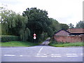
Road to Mells
At the junction with the B1123 Southwold Road
Image: © Geographer
Taken: 7 Sep 2010
0.04 miles
2
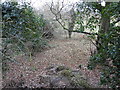
From the parapet of the Corner Farm bridge looking west
Towards Halesworth the former Southwold railway line is inaccessible at this point, the line being overgrown with trees and reclaimed.
Image: © Adrian S Pye
Taken: 4 Feb 2023
0.04 miles
4
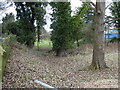
Southwold Railway line at Mells Corner Farm bridge
The sloping ground is concealing the retaining wall with the former track between the two ivy-clad trees
Image: © Adrian S Pye
Taken: 4 Feb 2023
0.05 miles
5
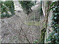
Mells railway bridge looking around the eastern parapet
The tunnel entrance and the retaining "wing" wall can be seen on the south side of the entrance
Image: © Adrian S Pye
Taken: 4 Feb 2023
0.05 miles
6
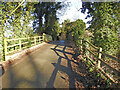
Former railway bridge at Mells
The bridge, designated #4 was known as Ball's Bridge or Corner Farm bridge, carried the minor road over the Halesworth to Southwold railway line.
It was reconstructed in 1906/7 from the original, in brick and has a 20 foot span.
Image: © Adrian S Pye
Taken: 9 Jan 2023
0.05 miles
7
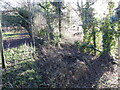
The site of the former Southwold Railway looking east
Taken from the bridge overlooking the parapet towards Wenhaston along the former Southwold Railway track
Image: © Adrian S Pye
Taken: 9 Jan 2023
0.06 miles
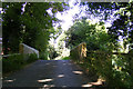
10
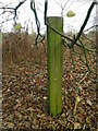
Southwold Railway fence post
The Southwold railway used their sleepers (6' x 6" x 3")as fence posts alongside the trackbed. Very well creosoted, a number survive, even after 100yrs or more.
This is one of several just east of the Mels road bridge over the trackbed.
Image: © Tim Royall
Taken: 14 Dec 2021
0.10 miles