
IMAGES TAKEN NEAR TO
Beckers View, HALESWORTH, IP19 9FA
Introduction
This page details the photographs taken nearby to Beckers View, IP19 9FA by members of the Geograph project.
The Geograph project started in 2005 with the aim of publishing, organising and preserving representative images for every square kilometre of Great Britain, Ireland and the Isle of Man.

There are currently over 7.5m images from over14,400 individuals and you can help contribute to the project by visiting https://www.geograph.org.uk
Image Map
Images are licensed for reuse under creativecommons.org/licenses/by-sa/2.0
Notes
- Clicking on the map will re-center to the selected point.
- The higher the marker number, the further away the image location is from the centre of the postcode.
Image Listing (125 Images Found)
Images are licensed for reuse under creativecommons.org/licenses/by-sa/2.0
Image
Details
Distance
1
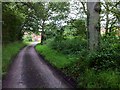
Blower's Common
View south-west along the footpath and farm drive within the tiny Blower's Common. Blower's Common is a one-third hectare common straddling the track underneath the trees; the common is now under the legal management of Suffolk Coastal District Council, but locally managed by a partnership with other organisations. Bizarrely, what was left of the uncultivated grassland on the right side of the track has been planted with saplings, making even this small open space virtually inaccessible.
At the end of the track, at the junction with Narrow Way, is a small, new affordable housing development by Hastoe Housing Association.
Image: © Hugh Craddock
Taken: 20 Jul 2012
0.08 miles
2
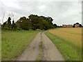
Blower's Common
View south-west along the footpath and farm drive towards Blower's Common and the eastern end of Narrow Way. Blower's Common is a tiny, one-third hectare common straddling the track among the trees directly ahead, presumably a relic of a larger area which has long since been inclosed; the common is now legally under the management of Suffolk Coastal District Council, but locally managed by a partnership with other organisations. At the far end of the common, at the end of Narrow Way, is a small, new affordable housing development by Hastoe Housing Association.
Image: © Hugh Craddock
Taken: 20 Jul 2012
0.13 miles
3
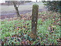
Blowers Common marker
I found three of these markers all in fairly close proximity and assume they mark something other than a boundary. No doubt there are more to find.
Image: © Adrian S Pye
Taken: 26 Jan 2023
0.14 miles
4
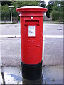
Post Office The Street Postbox
Postbox No.IP19 5560
Image: © Geographer
Taken: 27 Aug 2011
0.15 miles
5
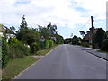
Hall Road, Wenhaston
Looking towards the School near the footpath to St.Michael's Way
Image: © Geographer
Taken: 17 Aug 2012
0.15 miles

7
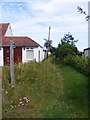
Footpath to St.Michael's Way
Off Hall Road
Image: © Geographer
Taken: 17 Aug 2012
0.15 miles
8
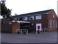
Wenhaston Village Hall & Post Office & Post Office The Street Postbox
Postbox No.IP19 5560
Image: © Geographer
Taken: 27 Aug 2011
0.15 miles
9
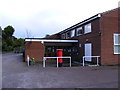
Wenhaston Village Hall & Post Office & Post Office The Street Postbox
Wenhaston Village Hall & Post Office & Post Office The Street Postbox No.IP19 5560
Image: © Geographer
Taken: 27 Aug 2011
0.16 miles
10
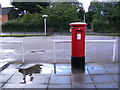
Post Office The Street Postbox
Postbox No.IP19 5560
Image: © Geographer
Taken: 27 Aug 2011
0.16 miles