IMAGES TAKEN NEAR TO
Church Hill, HALESWORTH, IP19 9AX
Introduction
This page details the photographs taken nearby to Church Hill, IP19 9AX by members of the Geograph project.
The Geograph project started in 2005 with the aim of publishing, organising and preserving representative images for every square kilometre of Great Britain, Ireland and the Isle of Man.

There are currently over 7.5m images from over14,400 individuals and you can help contribute to the project by visiting https://www.geograph.org.uk
Image Map
Images are licensed for reuse under creativecommons.org/licenses/by-sa/2.0
Notes
- Clicking on the map will re-center to the selected point.
- The higher the marker number, the further away the image location is from the centre of the postcode.
Image Listing (274 Images Found)
Images are licensed for reuse under creativecommons.org/licenses/by-sa/2.0
Image
Details
Distance
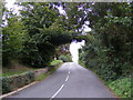
1
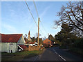
St.Mary's Church & B1117 Church Hill
Near the junction with Peasenhall Road
Image: © Geographer
Taken: 3 Mar 2014
0.02 miles
2
The Clink Bridleway to Bucks Farm & Cookley Street
Also the entrance to Old Hall Farm,Walpole
Off the B1117 Church Hill
Walpole Bridleway No.5 leading to Cookley footpath No.19
Image: © Geographer
Taken: 16 Sep 2010
0.02 miles
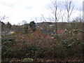
4
Footpath to Bramfield Road
Off the B1117 Church Hill
Walpole footpath No.4
Image: © Geographer
Taken: 16 Sep 2010
0.03 miles
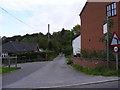
5
B1117 Church Hill, Walpole
Looking towards Halesworth near St.Mary's Church
Image: © Geographer
Taken: 16 Sep 2010
0.03 miles
6
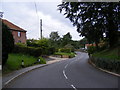
B1117 Church Hill, Walpole
Looking towards the junction with Peasenhall Road near St.Mary's Church
Image: © Geographer
Taken: 16 Sep 2010
0.03 miles
7
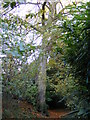
Beech Tree on the footpath to Bramfield Road
Image: © Geographer
Taken: 2 Nov 2012
0.04 miles
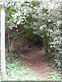
8
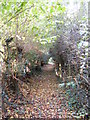
Footpath to the B1117 Church Hill
Off Bramfield Road
Image: © Geographer
Taken: 2 Nov 2012
0.04 miles
9
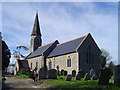
Walpole St Mary?s church
There has been a church here since the earliest days of Christianity. It is fitting that just up the road from the church is the oldest chapel in the county. converted in 1647, in the middle of the Civil War, from a 40-years-old meeting-house. The parish church dates from the 14th century but Saxon workmanship can still be seen today in the glacial erratics used as quoin stones in the walls of nave and chancel alike. The tower and spire are modern. The porch is 14th century and has a scratch dial. The Norman doorway is rich in zigzag chevron decoration and inside there is a Norman stoup with broken bowl, now just a niche. The sedilia and piscina with cusped pediment are both 14th century. The holy table is Jacobean. High on the wall of the nave are the gilded plaster Hanoverian Royal Arms.
Image: © Adrian S Pye
Taken: 16 Mar 2007
0.04 miles
10
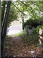
Footpath to the B1117 Church Hill
Off Bramfield Road
Walpole Footpath No.4
Image: © Geographer
Taken: 2 Nov 2012
0.04 miles