IMAGES TAKEN NEAR TO
Holmere Drive, HALESWORTH, IP19 8TR
Introduction
This page details the photographs taken nearby to Holmere Drive, IP19 8TR by members of the Geograph project.
The Geograph project started in 2005 with the aim of publishing, organising and preserving representative images for every square kilometre of Great Britain, Ireland and the Isle of Man.

There are currently over 7.5m images from over14,400 individuals and you can help contribute to the project by visiting https://www.geograph.org.uk
Image Map
Images are licensed for reuse under creativecommons.org/licenses/by-sa/2.0
Notes
- Clicking on the map will re-center to the selected point.
- The higher the marker number, the further away the image location is from the centre of the postcode.
Image Listing (574 Images Found)
Images are licensed for reuse under creativecommons.org/licenses/by-sa/2.0
Image
Details
Distance
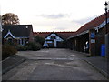
3
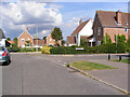
Holmere Drive, Halesworth
At the junction with Aldergrove Close
Image: © Geographer
Taken: 20 Aug 2012
0.03 miles
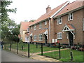
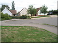
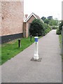
4
Lamppost on the path from the B1123 to Holmere Drive
Image: © Basher Eyre
Taken: 10 Aug 2010
0.04 miles
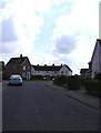
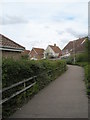
7
Cyclepath from Roman Way to Halesworth town centre
Image: © Basher Eyre
Taken: 10 Aug 2010
0.05 miles
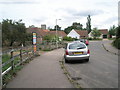
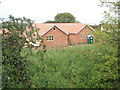
8
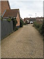
Path from the B1123 entering Holmere Drive
Image: © Basher Eyre
Taken: 10 Aug 2010
0.05 miles