IMAGES TAKEN NEAR TO
Dakings Drift, HALESWORTH, IP19 8TQ
Introduction
This page details the photographs taken nearby to Dakings Drift, IP19 8TQ by members of the Geograph project.
The Geograph project started in 2005 with the aim of publishing, organising and preserving representative images for every square kilometre of Great Britain, Ireland and the Isle of Man.

There are currently over 7.5m images from over14,400 individuals and you can help contribute to the project by visiting https://www.geograph.org.uk
Image Map
Images are licensed for reuse under creativecommons.org/licenses/by-sa/2.0
Notes
- Clicking on the map will re-center to the selected point.
- The higher the marker number, the further away the image location is from the centre of the postcode.
Image Listing (151 Images Found)
Images are licensed for reuse under creativecommons.org/licenses/by-sa/2.0
Image
Details
Distance
1
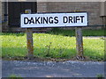
Daking's Drift sign
On Daking's Drift at the junction with Dukes Drive
Image: © Geographer
Taken: 10 Aug 2012
0.03 miles
3
Dukes Drive, Halesworth
At the junction with Daking's Drift
Image: © Geographer
Taken: 10 Aug 2012
0.03 miles
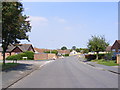
4
Dukes Drive, Halesworth
At the junction with Daking's Drift
Image: © Geographer
Taken: 10 Aug 2012
0.04 miles
5
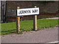
Jermyn Way sign
On Jermyn Way at the junction with Dukes Drive
Image: © Geographer
Taken: 10 Aug 2012
0.05 miles
6
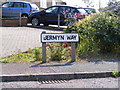
Jermyn Way sign
On Jermyn Way at the junction with Dukes Drive
Image: © Geographer
Taken: 10 Aug 2012
0.05 miles
7
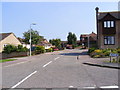
Jermyn Way, Halesworth
At the junction with Dukes Drive
Image: © Geographer
Taken: 10 Aug 2012
0.05 miles
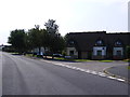
8
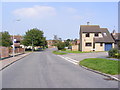
Dukes Drive, Halesworth
At the junction with Jermyn Way
Image: © Geographer
Taken: 10 Aug 2012
0.05 miles
9
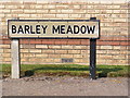
Barley Meadow sign
On Barley Meadow at the junction with Dukes Drive
Image: © Geographer
Taken: 10 Aug 2012
0.08 miles
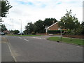
10
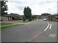
Junction of Gainsborough Drive and Clay Hills
Image: © Basher Eyre
Taken: 10 Aug 2010
0.08 miles