
IMAGES TAKEN NEAR TO
Blyth Mews, HALESWORTH, IP19 8FB
Introduction
This page details the photographs taken nearby to Blyth Mews, IP19 8FB by members of the Geograph project.
The Geograph project started in 2005 with the aim of publishing, organising and preserving representative images for every square kilometre of Great Britain, Ireland and the Isle of Man.

There are currently over 7.5m images from over14,400 individuals and you can help contribute to the project by visiting https://www.geograph.org.uk
Image Map
Images are licensed for reuse under creativecommons.org/licenses/by-sa/2.0
Notes
- Clicking on the map will re-center to the selected point.
- The higher the marker number, the further away the image location is from the centre of the postcode.
Image Listing (864 Images Found)
Images are licensed for reuse under creativecommons.org/licenses/by-sa/2.0
Image
Details
Distance
1
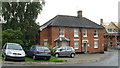
Older houses next to the new build in Quay Street
Image: © Basher Eyre
Taken: 10 Aug 2010
0.02 miles
5
New reach junction in Town Park
At the junction with Town River
Image: © Geographer
Taken: 6 Dec 2013
0.02 miles
6

Former lock on the River Blyth, left; ahead is the Blyth
The lock was built on the instructions of Patrick Stead, a wealthy maltster, 200 years ago as a means of passage between the River Blyth and the New Reach Navigation (which was constructed in 1761), so barges could reach and unload coal and barley at his new maltings beside the Blyth and take on malt for delivery. The New Reach has an approximate length of just over 700 yards and created navigable waters for barges from the port at Southwold.
Image: © Adrian S Pye
Taken: 4 Feb 2023
0.02 miles
7

Footbridge over New Reach to the Langley's Quay housing estate
Image: © Geographer
Taken: 6 Dec 2013
0.02 miles
8

The former lock at Halesworth
The lock was built 200 years ago in the 1820s, between the River Blyth and New Reach Navigation. see also Image
Image: © Adrian S Pye
Taken: 4 Feb 2023
0.03 miles
9

The former lock at Halesworth
The lock was constructed in the 1820s on the instructions of Patrick Stead, a wealthy maltster. The lock made the connection between the River Blyth and the New Reach canal, a 700 yard long bypass around the narrow and winding part of the Blyth. Stead built new maltings on the River Blyth and needed better access to them via the channel which since its construction in 1761 served only the quay with no access to the River Blyth.
Image: © Adrian S Pye
Taken: 4 Feb 2023
0.03 miles
10

Dried up section of New Reach
Looking towards the shelter
Image: © Geographer
Taken: 6 Dec 2013
0.03 miles