IMAGES TAKEN NEAR TO
Ubbeston, HALESWORTH, IP19 0EY
Introduction
This page details the photographs taken nearby to IP19 0EY by members of the Geograph project.
The Geograph project started in 2005 with the aim of publishing, organising and preserving representative images for every square kilometre of Great Britain, Ireland and the Isle of Man.

There are currently over 7.5m images from over14,400 individuals and you can help contribute to the project by visiting https://www.geograph.org.uk
Image Map
Images are licensed for reuse under creativecommons.org/licenses/by-sa/2.0
Notes
- Clicking on the map will re-center to the selected point.
- The higher the marker number, the further away the image location is from the centre of the postcode.
Image Listing (14 Images Found)
Images are licensed for reuse under creativecommons.org/licenses/by-sa/2.0
Image
Details
Distance
1
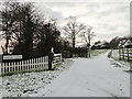
Entrance to Valley Farm, Ubbeston, Suffolk
Image: © Adrian S Pye
Taken: 28 Nov 2010
0.03 miles
2
The entrance to Church Farm & West Cottage
Off Low Road, Ubbeston
Image: © Geographer
Taken: 17 Oct 2011
0.04 miles
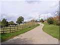
3
Low Road, Ubbeston
Near Valley Farm
Road No.U2710
Image: © Geographer
Taken: 3 Oct 2006
0.05 miles
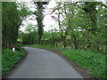
4
Low Road, Ubbeston
Near the footpath to St.Peter's Church & Barell's Hill
Image: © Geographer
Taken: 17 Oct 2011
0.05 miles
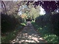
5
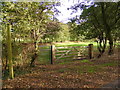
Footpath to St.Peter's Church, Ubbeston & Barell's Hill
Off Low Road
Image: © Geographer
Taken: 17 Oct 2011
0.06 miles
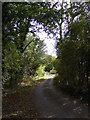
6
Country Lane
Country lane and footpath sign near to Ubbeston, Suffolk.
Image: © Keith Evans
Taken: 10 Apr 2014
0.06 miles
7
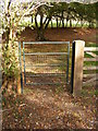
Footpath Gate of the footpath to St.Peter's Church, Ubbeston & Barell's Hill
Off Low Road
Image: © Geographer
Taken: 17 Oct 2011
0.07 miles
8
Footpath to St.Peter's Church, Ubbeston & Barell's Hill
Off Low Road
Image: © Geographer
Taken: 17 Oct 2011
0.07 miles
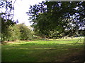
9
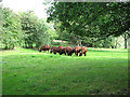
Cattle grazing pasture east of Ubbeston Wood, Ubbeston
Image: © Evelyn Simak
Taken: 20 Sep 2011
0.08 miles
10
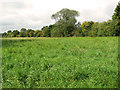
Trees growing beside Low Road, Ubbeston
Image: © Evelyn Simak
Taken: 20 Sep 2011
0.11 miles