IMAGES TAKEN NEAR TO
Linstead, HALESWORTH, IP19 0DT
Introduction
This page details the photographs taken nearby to IP19 0DT by members of the Geograph project.
The Geograph project started in 2005 with the aim of publishing, organising and preserving representative images for every square kilometre of Great Britain, Ireland and the Isle of Man.

There are currently over 7.5m images from over14,400 individuals and you can help contribute to the project by visiting https://www.geograph.org.uk
Image Map
Images are licensed for reuse under creativecommons.org/licenses/by-sa/2.0
Notes
- Clicking on the map will re-center to the selected point.
- The higher the marker number, the further away the image location is from the centre of the postcode.
Image Listing (36 Images Found)
Images are licensed for reuse under creativecommons.org/licenses/by-sa/2.0
Image
Details
Distance
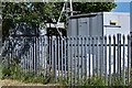
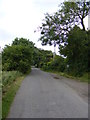
1
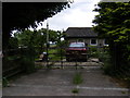
Entrance to the Bungalow off North Green Road
Near Catkin Farm
Image: © Geographer
Taken: 27 Jun 2013
0.01 miles
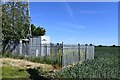
3
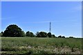
Metfield Common, Grove Farm: Mast at Catkin Farm
Image: © Michael Garlick
Taken: 29 May 2020
0.02 miles
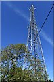
4
North Green Road & Transmitter Mast near Catkin Farm
Image: © Geographer
Taken: 30 Nov 2011
0.02 miles
5
Metfield Common, Grove Farm: Mast at Catkin Farm
Image: © Michael Garlick
Taken: 29 May 2020
0.03 miles
6
Metfield Common, Grove Farm: Mast at Catkin Farm
Image: © Michael Garlick
Taken: 29 May 2020
0.03 miles
7
Metfield Common, Grove Farm: Mast at Catkin Farm
Image: © Michael Garlick
Taken: 29 May 2020
0.03 miles
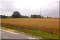
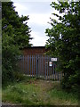
9
North Green Road
Looking towards Catkin Farm near the WT Station
Image: © Geographer
Taken: 27 Jun 2013
0.03 miles
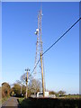
10
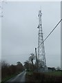
Transmitter mast
Transmitter mast near to North Green Suffolk.
Image: © Keith Evans
Taken: 15 Mar 2008
0.03 miles