IMAGES TAKEN NEAR TO
Bell Green, HALESWORTH, IP19 0DN
Introduction
This page details the photographs taken nearby to Bell Green, IP19 0DN by members of the Geograph project.
The Geograph project started in 2005 with the aim of publishing, organising and preserving representative images for every square kilometre of Great Britain, Ireland and the Isle of Man.

There are currently over 7.5m images from over14,400 individuals and you can help contribute to the project by visiting https://www.geograph.org.uk
Image Map
Images are licensed for reuse under creativecommons.org/licenses/by-sa/2.0
Notes
- Clicking on the map will re-center to the selected point.
- The higher the marker number, the further away the image location is from the centre of the postcode.
Image Listing (30 Images Found)
Images are licensed for reuse under creativecommons.org/licenses/by-sa/2.0
Image
Details
Distance
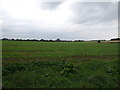
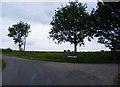
1
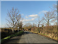
Passing place on a country road near Cratfield
Image: © Adrian S Pye
Taken: 18 Jan 2011
0.08 miles
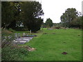
3
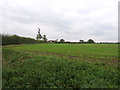
Crop field and hedgerow, Cratfield
Off Bell Green.
Image: © JThomas
Taken: 13 Oct 2016
0.12 miles
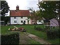
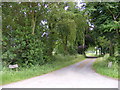
4
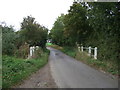
Bell Green
Heading north west from Cratfield.
Image: © JThomas
Taken: 13 Oct 2016
0.16 miles
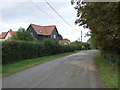
7
North Green Road, Cratfield
At the entrance to Linstead Farm
Image: © Geographer
Taken: 24 Jun 2013
0.19 miles
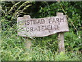
8
Entrance to Linstead Farm
Off North Green Road
Image: © Geographer
Taken: 24 Jun 2013
0.19 miles