IMAGES TAKEN NEAR TO
Halesworth Road, HALESWORTH, IP19 0AE
Introduction
This page details the photographs taken nearby to Halesworth Road, IP19 0AE by members of the Geograph project.
The Geograph project started in 2005 with the aim of publishing, organising and preserving representative images for every square kilometre of Great Britain, Ireland and the Isle of Man.

There are currently over 7.5m images from over14,400 individuals and you can help contribute to the project by visiting https://www.geograph.org.uk
Image Map
Images are licensed for reuse under creativecommons.org/licenses/by-sa/2.0
Notes
- Clicking on the map will re-center to the selected point.
- The higher the marker number, the further away the image location is from the centre of the postcode.
Image Listing (14 Images Found)
Images are licensed for reuse under creativecommons.org/licenses/by-sa/2.0
Image
Details
Distance
2
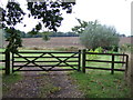
Field entrance off Chediston Street (B1123)
Image: © JThomas
Taken: 13 Oct 2016
0.13 miles
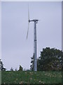
4
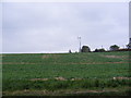
Wind Turbine near Mill House
Off the B1123 Chediston Street
Image: © Geographer
Taken: 11 Oct 2012
0.16 miles
5
Wind Turbine near Mill House
Off the B1123 Chediston Street
(Close up)
Image: © Geographer
Taken: 11 Oct 2012
0.16 miles
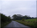
6
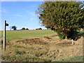
Bridleway to Chediston Green
Off the B1123 Cheadiston Street
Image: © Geographer
Taken: 20 Oct 2011
0.19 miles
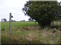
7
Bridleway to Chediston Green
Off the B1123 Cheadiston Street
Image: © Geographer
Taken: 20 Oct 2011
0.19 miles
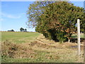
8
Bridleway to Chediston Green
Off the B1123 Chediston Street near Packway Farm
Image: © Geographer
Taken: 11 Oct 2012
0.19 miles
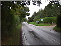
9
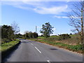
B1123 Chediston Street
Looking towards Chediston near the bridleway to Chediston Green
Image: © Geographer
Taken: 20 Oct 2011
0.19 miles
10
B1123 Chediston Street & the Bridleway to Chediston Green
Image: © Geographer
Taken: 11 Oct 2012
0.20 miles