IMAGES TAKEN NEAR TO
Stocks Lane, SOUTHWOLD, IP18 6UJ
Introduction
This page details the photographs taken nearby to Stocks Lane, IP18 6UJ by members of the Geograph project.
The Geograph project started in 2005 with the aim of publishing, organising and preserving representative images for every square kilometre of Great Britain, Ireland and the Isle of Man.

There are currently over 7.5m images from over14,400 individuals and you can help contribute to the project by visiting https://www.geograph.org.uk
Image Map
Images are licensed for reuse under creativecommons.org/licenses/by-sa/2.0
Notes
- Clicking on the map will re-center to the selected point.
- The higher the marker number, the further away the image location is from the centre of the postcode.
Image Listing (166 Images Found)
Images are licensed for reuse under creativecommons.org/licenses/by-sa/2.0
Image
Details
Distance
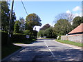
1
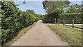
Stocks Lane
Stocks Lane heading to The Street
Image: © Shaun Ferguson
Taken: 15 Jun 2021
0.02 miles
2
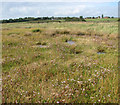
Saltmarsh below Walberswick
The adjoining beach > http://www.geograph.org.uk/photo/2077269 has been raised in order to protect the marshland which forms part of the Walberswick Nature Reserve, on the other side, from being flooded by salt water. Marram grass is growing along the ridge.
Walberswick Nature Reserve is one of three National Nature Reserves managed by English Nature. It is one of the most diverse sites in the UK with internationally important and unique groupings of habitation in a small area. The Reserve is made up of some of the best remaining areas of Sandlings heathland, together with reed beds at Westwood Marshes, which are some of the largest in the country, grassland, woodlands, shingle, saline lagoons and mudflats and the salt marshes of the tidal Blyth estuary. The reeds are still used commercially for thatching, a practise that helps to manage the water level in the reed bed for rare wildlife. The reserve is internationally important for its enormous variety of birdlife including Marsh Harrier, Bearded Tit, Water Rail and Bittern. The sea sometimes breaks through the shingle bank in winter, flooding the freshwater marshes, with potentially disastrous consequences for the wildlife that depends on the area.
Image: © Evelyn Simak
Taken: 21 Sep 2010
0.08 miles
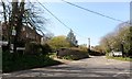
5
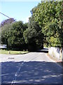
The Street, Walberswick
At the junction with Lodge Road
Image: © Geographer
Taken: 1 Sep 2011
0.09 miles
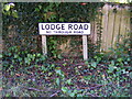
6
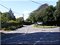
Lodge Road, Walberswick
At the junction with The Street
Image: © Geographer
Taken: 1 Sep 2011
0.09 miles
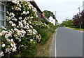
9
B1438 The Street, Walberswick
Looking towards the junction with Lodge Road
Image: © Geographer
Taken: 1 Sep 2011
0.11 miles
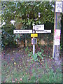
10
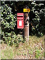
Palmers Lane Postbox
Postbox No.IP19 5535
Image: © Geographer
Taken: 1 Sep 2011
0.11 miles