
IMAGES TAKEN NEAR TO
Hillfield Court, SOUTHWOLD, IP18 6RU
Introduction
This page details the photographs taken nearby to Hillfield Court, IP18 6RU by members of the Geograph project.
The Geograph project started in 2005 with the aim of publishing, organising and preserving representative images for every square kilometre of Great Britain, Ireland and the Isle of Man.

There are currently over 7.5m images from over14,400 individuals and you can help contribute to the project by visiting https://www.geograph.org.uk
Image Map
Images are licensed for reuse under creativecommons.org/licenses/by-sa/2.0
Notes
- Clicking on the map will re-center to the selected point.
- The higher the marker number, the further away the image location is from the centre of the postcode.
Image Listing (134 Images Found)
Images are licensed for reuse under creativecommons.org/licenses/by-sa/2.0
Image
Details
Distance
1
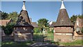
The Rest for the Aged
The Rest for the Aged a group of four Almshouses
https://historicengland.org.uk/listing/the-list/list-entry/1032139
Image: © Shaun Ferguson
Taken: 13 Jun 2021
0.07 miles
2
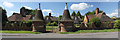
The Rest, 7-15 Covert Road, Reydon
Grade II Listed, Reydon's Alms houses opened in 1908. The benefactor was Andrew Matthews, a successful art dealer. It was a charitable housing development for eight people. Residents had to be natives of Southwold, to have lived there for more than twenty years, to have a limited income, to be over 65 years of age and to be of good physical and mental health. One unusual rule was that any resident displaying a certain photograph of his wife, Ellen, on her birthday, was given a 5 shilling reward. When built they had no running water, electricity or gas and no WC they were, however, fully furnished to a high standard. The first male resident was John Page, a marshman.
Image: © Jo and Steve Turner
Taken: 15 Jun 2017
0.08 miles
3
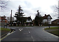
Nightingale Avenue, Reydon
At the junction with the B1126 Wangford Road
Road No.U1623
Image: © Geographer
Taken: 3 Apr 2018
0.10 miles
4
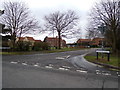
Nightingale Avenue, Reydon
At the junction with the B1126 Wangford Road
Road No.U1623
Image: © Geographer
Taken: 3 Apr 2018
0.10 miles
5
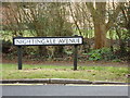
Nightingale Avenue sign
On Nightingale Avenue at the junction with the B1126 Wangford Road
Road No.U1623
Image: © Geographer
Taken: 3 Apr 2018
0.10 miles
6
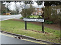
Nightingale Avenue sign
On Nightingale Avenue at the junction with the B1126 Wangford Road
Road No.U1623
Image: © Geographer
Taken: 3 Apr 2018
0.10 miles
7
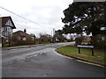
B1126 Wangford Road, Reydon
At the junction with Nightingale Avenue
Image: © Geographer
Taken: 3 Apr 2018
0.10 miles
8
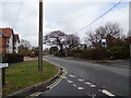
B1126 Wangford Road, Reydon
At the junction with Nightingale Avenue
Image: © Geographer
Taken: 3 Apr 2018
0.10 miles
9
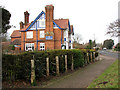
Wangford Road (B1126) past The Randolph public house, Reydon
Image: © Evelyn Simak
Taken: 4 Jan 2011
0.11 miles
10
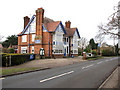
The Randolph public house, Reydon
The Randolph was briefly renamed "The Cricketers" because of the adjacent locality of Southwold's former Eversley School cricket ground and playing fields. It reverted to its original name after a few years.
Image: © Evelyn Simak
Taken: 4 Jan 2011
0.11 miles