
IMAGES TAKEN NEAR TO
Marlborough Road, SOUTHWOLD, IP18 6LR
Introduction
This page details the photographs taken nearby to Marlborough Road, IP18 6LR by members of the Geograph project.
The Geograph project started in 2005 with the aim of publishing, organising and preserving representative images for every square kilometre of Great Britain, Ireland and the Isle of Man.

There are currently over 7.5m images from over14,400 individuals and you can help contribute to the project by visiting https://www.geograph.org.uk
Image Map
Images are licensed for reuse under creativecommons.org/licenses/by-sa/2.0
Notes
- Clicking on the map will re-center to the selected point.
- The higher the marker number, the further away the image location is from the centre of the postcode.
Image Listing (1134 Images Found)
Images are licensed for reuse under creativecommons.org/licenses/by-sa/2.0
Image
Details
Distance
1

Evening sunlight in Southwold.
Interesting buildings catch evening sunlight at junction of Chester Road & Stradbroke Road.
Image: © Clive Warneford
Taken: 22 May 2001
0.00 miles
2
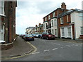
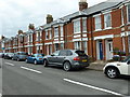
Looking from Stradbroke Road into Dunwich Road
Image: © Basher Eyre
Taken: 8 Aug 2010
0.02 miles
4
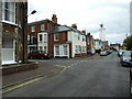
Approaching the junction of Stradbroke Road and Dunwich Road
Image: © Basher Eyre
Taken: 8 Aug 2010
0.02 miles
5
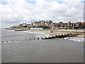
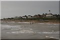
The seafront at Southwold, viewed from the pier
Image: © Roger Cornfoot
Taken: 18 Jun 2011
0.02 miles
7
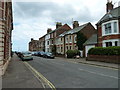
Looking from Stradbroke Road into Chester Road
Image: © Basher Eyre
Taken: 8 Aug 2010
0.03 miles
8
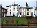
Houses on East Cliff, Southwold
Southwold is a seaside town on the Suffolk Heritage Coast. Almost an island, it is being bounded by the North Sea to the east, by the River Blyth and Southwold harbour to the south-west and by Buss Creek to the north, and there is only one road leading into and out of Southwold. Despite the Great Fire of 1659, which destroyed much of the town, many buildings of interest can still be seen. The fire created a number of open spaces, now greens, within the town. The town had a narrow-gauge Southwold Railway that connected to Halesworth and ran from the 24 September 1879 to April 1929. It has a lighthouse, a pier, and a sand and shingle beach that is protected by a number of sturdy new groynes. Southwold was the home of a number of Puritan emigrants to the Massachusetts Bay Colony in the early seventeenth century. In recent years an increasing number of houses have been bought as second homes, particularly by affluent Londoners.
Image: © Evelyn Simak
Taken: 4 Jan 2011
0.03 miles
10
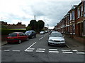
Looking from Stradbroke Road into Field Stile Road
Image: © Basher Eyre
Taken: 8 Aug 2010
0.03 miles