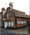
IMAGES TAKEN NEAR TO
Victoria Street, SOUTHWOLD, IP18 6HZ

Introduction

This page details the photographs taken nearby to Victoria Street, IP18 6HZ by members of the Geograph project.

The Geograph project started in 2005 with the aim of publishing, organising and preserving representative images for every square kilometre of Great Britain, Ireland and the Isle of Man.

There are currently over 7.5m images from over14,400 individuals and you can help contribute to the project by visiting https://www.geograph.org.uk

Image Map


Images are licensed for reuse under creativecommons.org/licenses/by-sa/2.0
Notes
  • Clicking on the map will re-center to the selected point.
  • The higher the marker number, the further away the image location is from the centre of the postcode.

Image Listing (1024 Images Found)

Images are licensed for reuse under creativecommons.org/licenses/by-sa/2.0
  • ...
Image
Details
Distance
1
The roof of the church of St. Edmund, Southwold
The eastern part of the ceiling of the 15th century church at Southwold, which is dedicated to St Edmund; a Christian Martyr and who was the last king of East Anglia. The western section (not shown) is unpainted being a reminder of the German bomb that damaged the church during the Second World War.
Image: © Alan Walker Taken: 12 Jul 2006
0.00 miles
2
St. Edmund, St. Edmund's Church, Southwold, Suffolk
Edmund was born in 841 and became the King of East Anglia in 865. In 869 he led his army against the Viking invaders but was defeated and captured. He refused to deny his Christian faith, was tied to a tree and shot with arrows until dead. This effigy, above the entrance to St. Edmund’s Church, Southwold in Suffolk commemorates this act of martyrdom.
Image: © Alan Walker Taken: 12 Jul 2006
0.00 miles
3
Southwold District Girl Guides Association HQ
Image: © Basher Eyre Taken: 8 Aug 2010
0.00 miles
4
A Tiny Southwold Front Door
Image: © Simon Bruce Taken: 20 Apr 2008
0.00 miles
5
Southwold Museum
More on the museum at this https://www.southwoldmuseum.org.
Image: © Jim Osley Taken: 30 Jun 2021
0.00 miles
6
Car park, Church Street
Image: © Basher Eyre Taken: 8 Aug 2010
0.02 miles
7
Church Street in mid August
Image: © Basher Eyre Taken: 8 Aug 2010
0.02 miles
8
Are they what they seem?
Church Street in mid August.
Image: © Basher Eyre Taken: 8 Aug 2010
0.02 miles
9
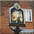
Southwold town sign
It depicts the Battle of Sole Bay in 1672 and was the first naval battle of the Third Anglo-Dutch War. 'Tis a pity the union flag of Great Britain, not introduced until 1801 is shown, and upside-down to boot. https://www.geograph.org.uk/photo/6636275
Image: © Adrian S Pye Taken: 12 Oct 2020
0.03 miles
10
Southwold town sign
The sign appears to be in someone's front garden. https://www.geograph.org.uk/photo/6636273
Image: © Adrian S Pye Taken: 12 Oct 2020
0.03 miles
  • ...