IMAGES TAKEN NEAR TO
The Street, SAXMUNDHAM, IP17 3QB
Introduction
This page details the photographs taken nearby to The Street, IP17 3QB by members of the Geograph project.
The Geograph project started in 2005 with the aim of publishing, organising and preserving representative images for every square kilometre of Great Britain, Ireland and the Isle of Man.

There are currently over 7.5m images from over14,400 individuals and you can help contribute to the project by visiting https://www.geograph.org.uk
Image Map
Images are licensed for reuse under creativecommons.org/licenses/by-sa/2.0
Notes
- Clicking on the map will re-center to the selected point.
- The higher the marker number, the further away the image location is from the centre of the postcode.
Image Listing (58 Images Found)
Images are licensed for reuse under creativecommons.org/licenses/by-sa/2.0
Image
Details
Distance
1
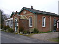
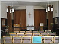
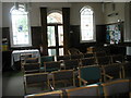
Darsham Methodist Church on an August Sunday
Image: © Basher Eyre
Taken: 8 Aug 2010
0.01 miles
3
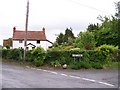
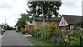
Cottages
Cottages on the corner of Fox Lane and The Street, Darsham
Image: © Claire Haystead
Taken: 12 May 2007
0.02 miles
6
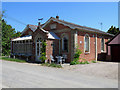
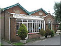
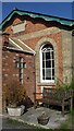
Darsham: former Primitive Methodist Chapel
Built in 1873, the chapel is now "Basil's Bolthole".
Image: © John Sutton
Taken: 22 May 2018
0.03 miles
7
Looking up Fox Lane towards the Methodist Church
Image: © Basher Eyre
Taken: 8 Aug 2010
0.03 miles
8
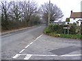
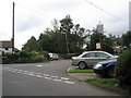
The Street, Darsham
At the junction with Fox Lane (U2811)
Road no. C225
Image: © Geographer
Taken: 16 Dec 2008
0.03 miles