IMAGES TAKEN NEAR TO
Low Road, SAXMUNDHAM, IP17 3PS
Introduction
This page details the photographs taken nearby to Low Road, IP17 3PS by members of the Geograph project.
The Geograph project started in 2005 with the aim of publishing, organising and preserving representative images for every square kilometre of Great Britain, Ireland and the Isle of Man.

There are currently over 7.5m images from over14,400 individuals and you can help contribute to the project by visiting https://www.geograph.org.uk
Image Map
Images are licensed for reuse under creativecommons.org/licenses/by-sa/2.0
Notes
- Clicking on the map will re-center to the selected point.
- The higher the marker number, the further away the image location is from the centre of the postcode.
Image Listing (24 Images Found)
Images are licensed for reuse under creativecommons.org/licenses/by-sa/2.0
Image
Details
Distance
1
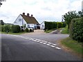
Cottage on the corner
Looking SW along Darsham Low Road towards cottage and road junction
Image: © Claire Haystead
Taken: 12 May 2007
0.01 miles
2
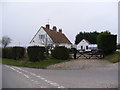
Old Hall Farm Cottage
At the junction with Low Road & Fox Lane
Image: © Geographer
Taken: 22 Mar 2013
0.01 miles
3
Low Road, Darsham
At the junction with Fox Lane
Image: © Geographer
Taken: 14 Aug 2012
0.02 miles
4
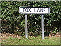
Fox Lane sign
On Fox Lane at the junction with Low Road
Image: © Geographer
Taken: 14 Aug 2012
0.02 miles
5

Low Road, Darsham
At the junction with Fox Lane (U2811) near Old Hall Farm Cottage
Road no.U2812
Image: © Geographer
Taken: 22 Mar 2013
0.02 miles
6
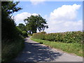
Fox Lane, Darsham
Near the junction with Low Road
Image: © Geographer
Taken: 14 Aug 2012
0.03 miles
7
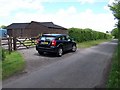
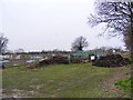
Stables at Low Lane, Darsham
A view up Low Lane, towards Darsham, showing the smart stables on the left hand side.
Image: © Trevor Alder
Taken: 12 May 2007
0.07 miles

9
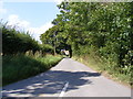
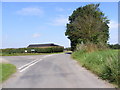
Low Road, Darsham
Looking towards Fox Lane near the junction with Westleton Road
Image: © Geographer
Taken: 14 Aug 2012
0.10 miles