IMAGES TAKEN NEAR TO
Carlton, SAXMUNDHAM, IP17 2QA
Introduction
This page details the photographs taken nearby to IP17 2QA by members of the Geograph project.
The Geograph project started in 2005 with the aim of publishing, organising and preserving representative images for every square kilometre of Great Britain, Ireland and the Isle of Man.

There are currently over 7.5m images from over14,400 individuals and you can help contribute to the project by visiting https://www.geograph.org.uk
Image Map
Images are licensed for reuse under creativecommons.org/licenses/by-sa/2.0
Notes
- Clicking on the map will re-center to the selected point.
- The higher the marker number, the further away the image location is from the centre of the postcode.
Image Listing (146 Images Found)
Images are licensed for reuse under creativecommons.org/licenses/by-sa/2.0
Image
Details
Distance
1
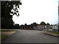
UK Power Networks
On Carlton Park Industrial Estate
http://www.ukpowernetworks.co.uk/
Image: © Geographer
Taken: 20 Jul 2014
0.02 miles
2
Ronald Lane & UK Power Networks
On Carlton Park Industrial Estate
Road No.U2526
http://www.ukpowernetworks.co.uk/
Image: © Geographer
Taken: 20 Jul 2014
0.02 miles
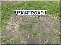
3

Carlton Park sign
Off the B1121 Main Road
Image: © Geographer
Taken: 19 Mar 2015
0.02 miles
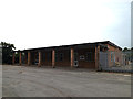
4
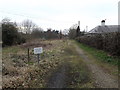
Track entrance into Carlton Park
Off the B1121 Main Road
Image: © Geographer
Taken: 19 Mar 2015
0.02 miles
5

Track entrance into Carlton Park
Off the B1121 Main Road
Image: © Geographer
Taken: 19 Mar 2015
0.02 miles
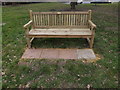
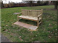
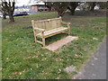
7
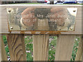
Plaque on the Seat off the B1121 Main Road
Image: © Geographer
Taken: 19 Mar 2015
0.02 miles