IMAGES TAKEN NEAR TO
Sibton, SAXMUNDHAM, IP17 2NE
Introduction
This page details the photographs taken nearby to IP17 2NE by members of the Geograph project.
The Geograph project started in 2005 with the aim of publishing, organising and preserving representative images for every square kilometre of Great Britain, Ireland and the Isle of Man.

There are currently over 7.5m images from over14,400 individuals and you can help contribute to the project by visiting https://www.geograph.org.uk
Image Map
Images are licensed for reuse under creativecommons.org/licenses/by-sa/2.0
Notes
- Clicking on the map will re-center to the selected point.
- The higher the marker number, the further away the image location is from the centre of the postcode.
Image Listing (88 Images Found)
Images are licensed for reuse under creativecommons.org/licenses/by-sa/2.0
Image
Details
Distance
1
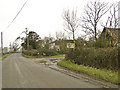
Entrance to White House Farm, Peasenhall
Image: © Adrian S Pye
Taken: 20 Feb 2011
0.01 miles
2
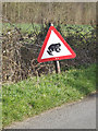
Roadsign on Rendham Road
Near White House Farm
Road No.C229
(Close up)
Image: © Geographer
Taken: 2 Apr 2015
0.02 miles
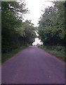
3
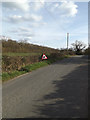
Rendham Road & roadsign
Near White House Farm
Road No.C229
Image: © Geographer
Taken: 2 Apr 2015
0.02 miles
4
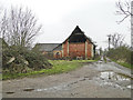
Farm building at White House Farm, Peasenhall
Image: © Adrian S Pye
Taken: 20 Feb 2011
0.02 miles
5
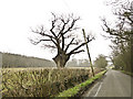
Gnarled old oak tree near White House Farm, Peasenhall
...and a leaning telegraph pole.
Image: © Adrian S Pye
Taken: 20 Feb 2011
0.05 miles
6
The Leaning Pole of Peasenhall
Leaning telephone pole near to Peasenhall, Suffolk.
Image: © Keith Evans
Taken: 23 Oct 2014
0.07 miles
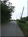
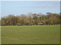
7
Rendham Road
Near White House Farm & Coe Wood
Road No.C229
Image: © Geographer
Taken: 18 May 2011
0.09 miles
9
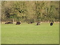
Hebridean Sheep at Corner Farm
Off Rendham Road
Image: © Geographer
Taken: 25 Dec 2014
0.11 miles
10
Hebridean Sheep at Corner Farm
Off Rendham Road
Image: © Geographer
Taken: 25 Dec 2014
0.11 miles