IMAGES TAKEN NEAR TO
Bruisyard, SAXMUNDHAM, IP17 2EE
Introduction
This page details the photographs taken nearby to IP17 2EE by members of the Geograph project.
The Geograph project started in 2005 with the aim of publishing, organising and preserving representative images for every square kilometre of Great Britain, Ireland and the Isle of Man.

There are currently over 7.5m images from over14,400 individuals and you can help contribute to the project by visiting https://www.geograph.org.uk
Image Map
Images are licensed for reuse under creativecommons.org/licenses/by-sa/2.0
Notes
- Clicking on the map will re-center to the selected point.
- The higher the marker number, the further away the image location is from the centre of the postcode.
Image Listing (9 Images Found)
Images are licensed for reuse under creativecommons.org/licenses/by-sa/2.0
Image
Details
Distance
1
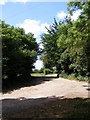
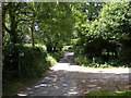
Footpath to Shrublands Farm & entrance to White House & Hill Top Farm
Off Church Road
The footpath to Shrublands Farm on Hollow Lane and the entrance to White House & Hill Top Farm.
Bruisyard footpath no.9 leading to Bruisyard footpath no.10
Image: © Geographer
Taken: 24 May 2011
0.21 miles
2
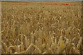
Wheat field and poppies, by the River Alde, Bruisyard
Image: © Christopher Hilton
Taken: 19 Jul 2020
0.22 miles
3
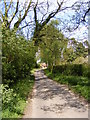
Church Road, Bruisyards
Looking towards St.Peter's Church
Image: © Geographer
Taken: 16 May 2010
0.23 miles
4
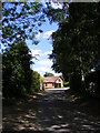
Church Road, Bruisyard
Looking towards St.Peter's Church near the footpath to Shrublands Farm
Image: © Geographer
Taken: 24 May 2011
0.23 miles
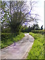
5
Church Road, Bruisyard and footpath to Shrublands Farm
Looking towards Low Road
Image: © Geographer
Taken: 24 May 2011
0.23 miles
6
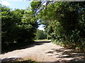
Footpath to Shrublands Farm & entrance to White House & Hill Top Farm
Off Church Road
The footpath to Shrublands Farm on Hollow Lane and the entrance to White House & Hill Top Farm.
Bruisyard footpath no.9 leading to Bruisyard footpath no.10
Image: © Geographer
Taken: 24 May 2011
0.23 miles
8
Church Road, Bruisyards
Looking towards the junction with Low Road
Road No.U2532
Image: © Geographer
Taken: 16 May 2010
0.24 miles
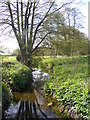
9
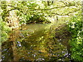
River Alde at Church Road Bridge
Looking towards Bruisyard
Image: © Geographer
Taken: 16 May 2010
0.25 miles