IMAGES TAKEN NEAR TO
Rendham, SAXMUNDHAM, IP17 2AS
Introduction
This page details the photographs taken nearby to IP17 2AS by members of the Geograph project.
The Geograph project started in 2005 with the aim of publishing, organising and preserving representative images for every square kilometre of Great Britain, Ireland and the Isle of Man.

There are currently over 7.5m images from over14,400 individuals and you can help contribute to the project by visiting https://www.geograph.org.uk
Image Map
Images are licensed for reuse under creativecommons.org/licenses/by-sa/2.0
Notes
- Clicking on the map will re-center to the selected point.
- The higher the marker number, the further away the image location is from the centre of the postcode.
Image Listing (11 Images Found)
Images are licensed for reuse under creativecommons.org/licenses/by-sa/2.0
Image
Details
Distance
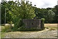
2
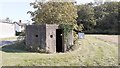
Peasenhall Pillbox
World War Two relic at Upper Grove Farm.
Image: © Ian Rob
Taken: 14 Sep 2020
0.03 miles
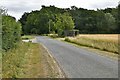
3
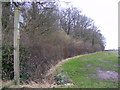
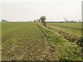
Footpath to Hill Farm Road & Bruisyard Road
Off Lintotts Road near Upper Grove Farm
Rendham footpath no.6 leading to Rendham footpath no.7
Image: © Geographer
Taken: 4 Feb 2011
0.03 miles
5
Peasenhall: Pillbox outside Upper Grove Farm
Image: © Michael Garlick
Taken: 6 Aug 2020
0.03 miles
6
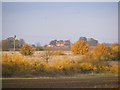
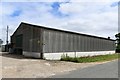
View of Grove Farm, Rendham
Taken from Hill Farm Road
Image: © Geographer
Taken: 1 Nov 2010
0.04 miles
7
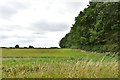
Peasenhall: Small wood in a large agricultural scene
Image: © Michael Garlick
Taken: 6 Aug 2020
0.04 miles
8
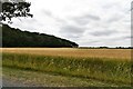
Peasenhall: Small wood in a large agricultural scene
Image: © Michael Garlick
Taken: 6 Aug 2020
0.10 miles
9
Peasenhall: Small wood in a large agricultural scene
Image: © Michael Garlick
Taken: 6 Aug 2020
0.11 miles
10
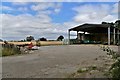
Looking towards Rotten End from near Upper Grove Farm
Image: © Adrian S Pye
Taken: 20 Feb 2011
0.18 miles