IMAGES TAKEN NEAR TO
Church Hill, SAXMUNDHAM, IP17 1EU
Introduction
This page details the photographs taken nearby to Church Hill, IP17 1EU by members of the Geograph project.
The Geograph project started in 2005 with the aim of publishing, organising and preserving representative images for every square kilometre of Great Britain, Ireland and the Isle of Man.

There are currently over 7.5m images from over14,400 individuals and you can help contribute to the project by visiting https://www.geograph.org.uk
Image Map
Images are licensed for reuse under creativecommons.org/licenses/by-sa/2.0
Notes
- Clicking on the map will re-center to the selected point.
- The higher the marker number, the further away the image location is from the centre of the postcode.
Image Listing (210 Images Found)
Images are licensed for reuse under creativecommons.org/licenses/by-sa/2.0
Image
Details
Distance
1
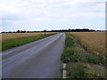
B1119 Saxmundham Road
Looking towards Leiston
Image: © Geographer
Taken: 13 Jul 2009
0.05 miles
3
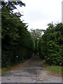
Entrance to The Manor House
Off the B1119 Church Hill
Image: © Geographer
Taken: 16 Aug 2013
0.06 miles
4
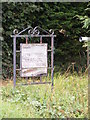
The Manor House sign
On the B1119 Church Hill
Image: © Geographer
Taken: 16 Aug 2013
0.06 miles
5

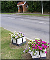
Bus Shelter on B1119 Church Hill, Saxmundham
Near the junction with Manor Gardens
Image: © Geographer
Taken: 7 Mar 2009
0.06 miles
6
Bus Shelter on the B1119 Church Hill, Saxmundham
Near the junction with Manor Gardens
Image: © Geographer
Taken: 13 Jul 2009
0.06 miles
7
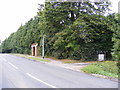
B1119 Church Hill & entrance to The Manor House
Image: © Geographer
Taken: 16 Aug 2013
0.06 miles
8
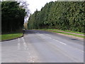
B1119 Church Hill, Saxmundham
At the junction with Manor Gardens
Image: © Geographer
Taken: 7 Mar 2009
0.06 miles
9
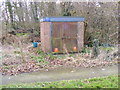
Gas Sub-Station
On the B1119 Church Hill at the junction with Manor Gardens, Saxmundham
Image: © Geographer
Taken: 7 Mar 2009
0.07 miles
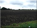
10
B1119 Saxmundham Road & Wood Farm entrance
Looking towards Leiston
Also Coltsclose Pickle footpath
Image: © Geographer
Taken: 7 Mar 2011
0.07 miles