IMAGES TAKEN NEAR TO
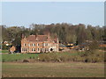
SAXMUNDHAM, IP17 1ER
Introduction
This page details the photographs taken nearby to IP17 1ER by members of the Geograph project.
The Geograph project started in 2005 with the aim of publishing, organising and preserving representative images for every square kilometre of Great Britain, Ireland and the Isle of Man.

There are currently over 7.5m images from over14,400 individuals and you can help contribute to the project by visiting https://www.geograph.org.uk
Image Map
Images are licensed for reuse under creativecommons.org/licenses/by-sa/2.0
Notes
- Clicking on the map will re-center to the selected point.
- The higher the marker number, the further away the image location is from the centre of the postcode.
Image Listing (154 Images Found)
Images are licensed for reuse under creativecommons.org/licenses/by-sa/2.0
Image
Details
Distance
1
Hurts Hall, Saxmundham
Taken from the B1121 Main Road
(Close up)
Image: © Geographer
Taken: 28 Jan 2016
0.08 miles
2
Hurts Hall seen across the Fromus valley
Image: © John Goldsmith
Taken: 18 Jul 2010
0.10 miles
3
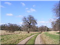
The entrance to Hurts Hall & Hall Farm
Looking towards the B1119 Church Hill
Image: © Geographer
Taken: 8 Mar 2012
0.14 miles
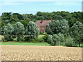
5
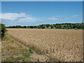
Across the Fromus valley to Hurts Hall
The river Fromus, hardly more than a stream, runs along the eastern (right) edge of this field. At one time it had a system of lock gates to create a lake at the bottom of this valley. Hurts Hall, the former home of the main local landowners, the Long family, is visible in the trees.
Image: © John Goldsmith
Taken: 18 Jul 2010
0.16 miles
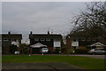
6
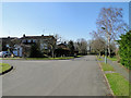
Manor Gardens, Saxmundham
A fairly modern housing small housing estate on the eastern side of the town.
Image: © Adrian S Pye
Taken: 7 Mar 2011
0.17 miles
7
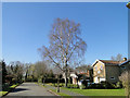
Silver Birch at Manor Gardens, Saxmundham
A fairly modern housing small housing estate on the eastern side of the town.
Image: © Adrian S Pye
Taken: 7 Mar 2011
0.17 miles
8
The entrance to Hurts Hall & Hall Farm
Looking towards the B1119 Church Hill
Image: © Geographer
Taken: 8 Mar 2012
0.18 miles
9
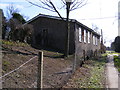
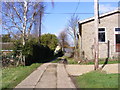
John the Baptist Church Hall
Off the B1119 Church Hill
Image: © Geographer
Taken: 8 Mar 2012
0.18 miles
10
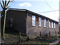
John the Baptist Church Hall
Off the B1119 Church Hill
Image: © Geographer
Taken: 8 Mar 2012
0.18 miles