
IMAGES TAKEN NEAR TO
Rendham Road, SAXMUNDHAM, IP17 1EA
Introduction
This page details the photographs taken nearby to Rendham Road, IP17 1EA by members of the Geograph project.
The Geograph project started in 2005 with the aim of publishing, organising and preserving representative images for every square kilometre of Great Britain, Ireland and the Isle of Man.

There are currently over 7.5m images from over14,400 individuals and you can help contribute to the project by visiting https://www.geograph.org.uk
Image Map
Images are licensed for reuse under creativecommons.org/licenses/by-sa/2.0
Notes
- Clicking on the map will re-center to the selected point.
- The higher the marker number, the further away the image location is from the centre of the postcode.
Image Listing (161 Images Found)
Images are licensed for reuse under creativecommons.org/licenses/by-sa/2.0
Image
Details
Distance
1
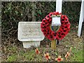
Saxmundham War Memorial Playing Field Plaque
The plaque is close to the entrance to the playing field bearing its name.
Image: © Adrian S Pye
Taken: 10 Aug 2014
0.04 miles
2
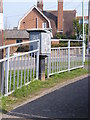
Royal Mail Dump Box
On the B1119 Rendham Road at the junction with Seaman Avenue
Image: © Geographer
Taken: 23 Mar 2012
0.04 miles
3
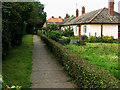
Queen's Close
Joining Fairfield Road to Saxon Road.
Image: © John Goldsmith
Taken: 18 Sep 2004
0.07 miles
4
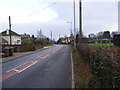
B1119 Rendham Road, Saxmundham
Looking towards Mill Road & Saxmundham
Image: © Geographer
Taken: 27 Dec 2008
0.07 miles
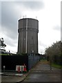
6
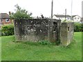
Hexagonal pillbox at Saxmundham
The pillbox, complete with concrete blast-wall faces the road both east and west and had been sealed to prevent children entering but the bricked-up entrance has been partly demolished. Inside there is a Y shaped ricochet wall.
Identical to the FW3/22 pillbox at Stratford St Andrew.
Image: © Adrian S Pye
Taken: 10 Aug 2014
0.08 miles
7
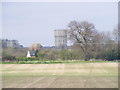
Saxmundham Water Tower
Taken from Kiln Lane,Benhall
Image: © Geographer
Taken: 9 Apr 2009
0.09 miles
8
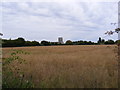
Saxmundham Water Tower & Saxmundham Middle School
Taken From the Railway Bridge - Saxmundham footpath no.17
Image: © Geographer
Taken: 24 Aug 2009
0.09 miles
9
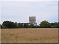
Saxmundham Water Tower & Saxmundham Middle School
Taken from the railway bridge - Saxmundham footpath no.17
(Close up)
Image: © Geographer
Taken: 24 Aug 2009
0.09 miles
10
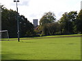
Saxmundham Water Tower
Off the B1119 Rendham Road taken from Carlton Park Playing Field
Image: © Geographer
Taken: 31 Oct 2008
0.09 miles