
IMAGES TAKEN NEAR TO
Fairfield Road, SAXMUNDHAM, IP17 1BB
Introduction
This page details the photographs taken nearby to Fairfield Road, IP17 1BB by members of the Geograph project.
The Geograph project started in 2005 with the aim of publishing, organising and preserving representative images for every square kilometre of Great Britain, Ireland and the Isle of Man.

There are currently over 7.5m images from over14,400 individuals and you can help contribute to the project by visiting https://www.geograph.org.uk
Image Map
Images are licensed for reuse under creativecommons.org/licenses/by-sa/2.0
Notes
- Clicking on the map will re-center to the selected point.
- The higher the marker number, the further away the image location is from the centre of the postcode.
Image Listing (319 Images Found)
Images are licensed for reuse under creativecommons.org/licenses/by-sa/2.0
Image
Details
Distance
1
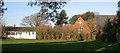
Saxmundham Primary School (disused) from St. John's Street
The school was opened around 1898 and the prefab extra classrooms added in the early 1950s. The school was replaced around 1998. Here it is viewed from St. John's Road, across the small playing field. Various plans for new uses have come to nothing.
Image: © John Goldsmith
Taken: 21 Jan 2006
0.03 miles
2

Inside Saxmundham Primary School
I think this is 'Class 1' where I started my school career. The photo was taken just before this building closed, and the school moved to brand new premises.
Photo scanned from a print so date not recorded.
Image: © John Goldsmith
Taken: Unknown
0.04 miles
3

Former Saxmundham Middle School
Off Fairfield Road
Image: © Geographer
Taken: 5 Mar 2011
0.04 miles
4
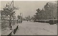
Fairfield Road, Saxmundham, 1940
The junction with Chapel Road is on the left.
The railings went "to build tanks" later in the war.
Photo is from family archives.
The scene is very similar today apart from the railings and the snow!
Image: © John Goldsmith
Taken: Unknown
0.04 miles
5

Saxmundham Primary courtyard
This is the old primary school, now disused, photographed just before closure. In the 1960s there was a swimming pool here.
Not sure of date as it's a scanned print.
Image: © John Goldsmith
Taken: Unknown
0.05 miles
6
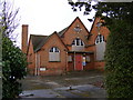
Former Saxmundham Middle School
Off Fairfield Road
Image: © Geographer
Taken: 5 Mar 2011
0.05 miles
7
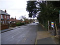
Fairfield Road, Saxmundham
Looking towards the B1121 North Entrance
Road No.U2526
Image: © Geographer
Taken: 5 Mar 2011
0.05 miles
9

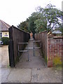
Saxmundham Primary School, disused
The school was built around 1898. Prefab classrooms were added in the 1950s, but it was replaced completely more recently and has been empty ever since.
Image: © John Goldsmith
Taken: 21 Jan 2006
0.05 miles
10
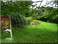
Mature pile of bricks
Under all that foliage on the left is a pile of bricks - not a wall but a loose pile ready for a building operation many years ago. Presumably the planning permission or the money fell through. The site is on the corner of Fairfield Road and Chapel Road.
Image: © John Goldsmith
Taken: 18 Sep 2008
0.08 miles