
IMAGES TAKEN NEAR TO
High Street, SAXMUNDHAM, IP17 1AF
Introduction
This page details the photographs taken nearby to High Street, IP17 1AF by members of the Geograph project.
The Geograph project started in 2005 with the aim of publishing, organising and preserving representative images for every square kilometre of Great Britain, Ireland and the Isle of Man.

There are currently over 7.5m images from over14,400 individuals and you can help contribute to the project by visiting https://www.geograph.org.uk
Image Map
Images are licensed for reuse under creativecommons.org/licenses/by-sa/2.0
Notes
- Clicking on the map will re-center to the selected point.
- The higher the marker number, the further away the image location is from the centre of the postcode.
Image Listing (716 Images Found)
Images are licensed for reuse under creativecommons.org/licenses/by-sa/2.0
Image
Details
Distance
1
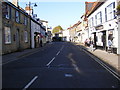
B1121 High Street, Saxmundham
Near The Queens Head & White Hart Public Houses
Image: © Geographer
Taken: 27 Oct 2008
0.00 miles
2
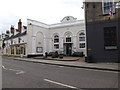
Saxmundham Polling Station
Off the B1121 High Street
Image: © Geographer
Taken: 7 May 2015
0.01 miles
4
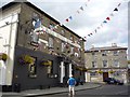
The Bell Hotel
Situated on the B1121 in Saxmundham.
Image: © DS Pugh
Taken: 28 Jul 2012
0.01 miles
5
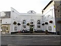
Saxmundham-United Kingdom Fellowship
Church on High Street.
Image: © Ian Rob
Taken: 17 Sep 2020
0.01 miles
6
![Saxmundham buildings [6]](https://s1.geograph.org.uk/geophotos/06/72/80/6728037_a00df1ba_120x120.jpg)
Saxmundham buildings [6]
The Market Hall was built as a corn exchange in 1836 and was greatly restored in 1992. The front is recessed between flanking walls with number 27 High Street on the left and the Bell Hotel, number 31 High Street Image on the right. Inside is a simple and plain hall which is home to an indoor market on Wednesdays. Listed, grade II, with details at: https://historicengland.org.uk/listing/the-list/list-entry/1365984
Saxmundham is a small market town about 5 miles from the Sussex coast and some 18 miles north east of Ipswich. The River Fromus, a tributary of the River Alde flows through the town. A market charter was first granted in 1272 and a market is still held every Wednesday. Until 1988 the town was astride the A12 trunk road but is now bypassed.
Image: © Michael Dibb
Taken: 10 Sep 2020
0.01 miles
7
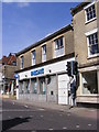
Barclays Bank PLC
On the B1122 High Street
Image: © Geographer
Taken: 26 May 2013
0.01 miles
8
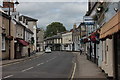
Saxmundham High St
Looking Northwards. The White Hart pub on the right was closed.
Image: © Robert Eva
Taken: 16 Jul 2016
0.01 miles
9
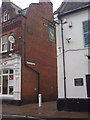
Fromus Square, Saxmundham
At the junction with the B1121 High Street
Image: © Geographer
Taken: 4 Nov 2012
0.01 miles
10
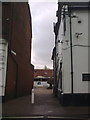
Fromus Square, Saxmundham
At the junction with the B1121 High Street
Image: © Geographer
Taken: 4 Nov 2012
0.01 miles