IMAGES TAKEN NEAR TO
Theberton, LEISTON, IP16 4TQ
Introduction
This page details the photographs taken nearby to IP16 4TQ by members of the Geograph project.
The Geograph project started in 2005 with the aim of publishing, organising and preserving representative images for every square kilometre of Great Britain, Ireland and the Isle of Man.

There are currently over 7.5m images from over14,400 individuals and you can help contribute to the project by visiting https://www.geograph.org.uk
Image Map
Images are licensed for reuse under creativecommons.org/licenses/by-sa/2.0
Notes
- Clicking on the map will re-center to the selected point.
- The higher the marker number, the further away the image location is from the centre of the postcode.
Image Listing (15 Images Found)
Images are licensed for reuse under creativecommons.org/licenses/by-sa/2.0
Image
Details
Distance
1
A Small Bridge, Hawthorn Road
Hawthorn Road crosses a small stream. You wouldn't know if it wasn't for the white railings.
Image: © Des Blenkinsopp
Taken: 23 Mar 2022
0.08 miles
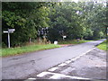
2
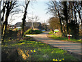
West end of Harrow Lane
West end of Harrow Lane
Image: © Richard West
Taken: 29 Mar 2009
0.09 miles
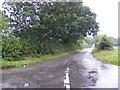
3
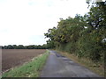
Hawthorn Road
At the junction with Harrow Road, looking towards Theberton
Road No.C227
Image: © Geographer
Taken: 8 Sep 2010
0.09 miles
4
Harrow Lane
At the junction with Hawthorn Road
Road No.U2407
Image: © Geographer
Taken: 8 Sep 2010
0.09 miles
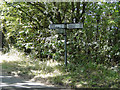
5
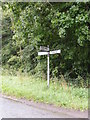
Roadsign on Hawthorn Road
At the junction with Harrow Road
Image: © Geographer
Taken: 8 Sep 2010
0.09 miles
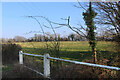
6
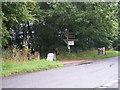
The Entrance to Peakhill Farm
Off Hawthorn Road
Image: © Geographer
Taken: 8 Sep 2010
0.10 miles
7
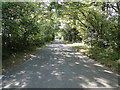
Road to Peakhill Farm
Peakhill Farm has a shop and a campsite.
Image: © Des Blenkinsopp
Taken: 23 Mar 2022
0.11 miles
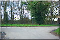
8
Hawthorn Road from the junction with Moat Road
Image: © Adrian S Pye
Taken: 15 Sep 2014
0.18 miles