IMAGES TAKEN NEAR TO
Sizewell, LEISTON, IP16 4TP
Introduction
This page details the photographs taken nearby to IP16 4TP by members of the Geograph project.
The Geograph project started in 2005 with the aim of publishing, organising and preserving representative images for every square kilometre of Great Britain, Ireland and the Isle of Man.

There are currently over 7.5m images from over14,400 individuals and you can help contribute to the project by visiting https://www.geograph.org.uk
Image Map
Images are licensed for reuse under creativecommons.org/licenses/by-sa/2.0
Notes
- Clicking on the map will re-center to the selected point.
- The higher the marker number, the further away the image location is from the centre of the postcode.
Image Listing (28 Images Found)
Images are licensed for reuse under creativecommons.org/licenses/by-sa/2.0
Image
Details
Distance
1

Crown Lodge, Leiston
Crown Lodge was built as the farmhouse of Crown Farm, the farmyard of which sits nearby.
Image: © Simon Mortimer
Taken: 7 Apr 2025
0.00 miles
2
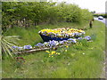
Floral Display on Lovers Lane
At the junction of King Georges Avenue
Image: © Geographer
Taken: 26 Apr 2010
0.04 miles
3
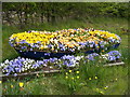
Floral Display on Lover's Lane
At the junction of King Georges Avenue
(Close up)
Image: © Geographer
Taken: 26 Apr 2010
0.04 miles
4
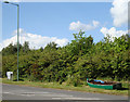
Roadside boat
At the junction of King Georges Avenue and Lover's Lane, Leiston. I can only think that this is a "novelty" flowerbed awaiting planting.
Image: © John Myers
Taken: 26 May 2009
0.05 miles
5

Grimsey's Lane near Crown Farm
Looking south along the bridleway towards Crown Lands Crossing.
Image: © Simon Mortimer
Taken: 7 Apr 2025
0.07 miles
6
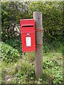
Crown Farm Postbox
On Lover's Lane near Crown Farm
Postbox No, IP16 4686
Image: © Geographer
Taken: 26 Apr 2010
0.09 miles
7
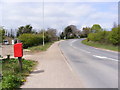
Lover's Lane, Leiston & Crown Farm Postbox
Near Crown Farm
Postbox No.IP16 4686
Image: © Geographer
Taken: 26 Apr 2010
0.09 miles
8
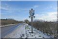
Sizewell village sign
The Sizewell sign has six elements, the uppermost is that of the Nuclear Power Station, run by EDF Energy. Below is the coastguard’s hut and a kittiwake, an inshore fishing boat with lobster pots on the beach. Smuggling is represented by the man with a barrel of cognac on his shoulder looking at the moon’s reflection on the water. Hanging from the name board is a fishing net, reinforcing the maritime nature of the village. https://www.geograph.org.uk/photo/6750465
Image: © Adrian S Pye
Taken: 10 Feb 2021
0.10 miles
9
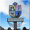
Sizewell village sign
The Sizewell sign has six elements, the uppermost is that of the Nuclear Power Station, run by EDF Energy. Below is the coastguard’s hut and a kittiwake, an inshore fishing boat with lobster pots on the beach. Smuggling is represented by the man with a barrel of cognac on his shoulder looking at the moon’s reflection on the water. Hanging from the name board is a fishing net, reinforcing the maritime nature of the village. https://www.geograph.org.uk/photo/6750468
Image: © Adrian S Pye
Taken: 10 Feb 2021
0.10 miles