IMAGES TAKEN NEAR TO
LEISTON, IP16 4RQ
Introduction
This page details the photographs taken nearby to IP16 4RQ by members of the Geograph project.
The Geograph project started in 2005 with the aim of publishing, organising and preserving representative images for every square kilometre of Great Britain, Ireland and the Isle of Man.

There are currently over 7.5m images from over14,400 individuals and you can help contribute to the project by visiting https://www.geograph.org.uk
Image Map
Images are licensed for reuse under creativecommons.org/licenses/by-sa/2.0
Notes
- Clicking on the map will re-center to the selected point.
- The higher the marker number, the further away the image location is from the centre of the postcode.
Image Listing (17 Images Found)
Images are licensed for reuse under creativecommons.org/licenses/by-sa/2.0
Image
Details
Distance
1
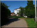
Upper Abbey
Upper Abbey near to Eastbridge, Suffolk.
Image: © Keith Evans
Taken: 5 Mar 2015
0.01 miles
2
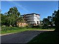
Upper Abbey Farm rises again (slowly)
Compare http://www.geograph.org.uk/photo/643206
Since the fire in December 2009, which destroyed the front portion of the house, the process of rebuilding has advanced slowly. In May 2014, the fire damaged parts seemed to have been cleared and a start made on repairing the brickwork.
Image: © Zorba the Geek
Taken: 22 May 2014
0.01 miles
3
Upper Abbey Farm under repair (from Northwest)
Compare http://www.geograph.org.uk/photo/643206
Since the fire in December 2009, which destroyed the front portion of the house, the process of rebuilding has advanced slowly. In May 2014, the fire damaged parts seemed to have been cleared and a start made on repairing the brickwork.
Image: © Zorba the Geek
Taken: 22 May 2014
0.01 miles
4
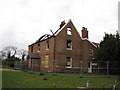
Upper Abbey Farm
The house was badly damaged by fire in December 2009. See Image for more information.
Image: © Chris Holifield
Taken: 5 Apr 2010
0.02 miles
5
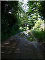
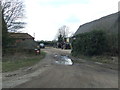
While you can (11): The "Back Road" passing Upper Abbey Farm
A series of images of places likely to change when Sizewell C Nuclear Power Station is built. This section of the old track from Lovers Lane towards Eastbridge may be relatively unaffected by the construction of Sizewell C, since the proposed road route and accommodation location avoid the farmhouse and farmyard themselves. Whether the track will remain a through route seems unlikely - a lost piece of history among many.
Image: © Zorba the Geek
Taken: 22 May 2014
0.03 miles
6
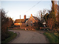
"I remember, I remember, the house where I was born"
Yes really: Upper Abbey Farm, Leiston, although it didn't look quite this way in 1944, when it was in fact two dwellings. Nowadays, judging by the number of cars outside, it is further subdivided and/or used for business premises. In case anyone's remotely interested, it was in the first floor room nearest the camera.
Later note: Less than two years from the date of this image, the front half of the house was almost totally destroyed by fire. This http://www.eadt.co.uk/content/eadt/news/story.aspx?brand=EADOnline&category=news&tBrand=EADonline&tCategory=News&itemid=IPED14%20Dec%202009%2021%3A54%3A28%3A783 used to work and may again. The story, though tragic, contained a strange coincidence: the landlord of the Image had seen the fire and, with the fire brigade at work, had gone on to Ipswich where he had run into the occupants of the farmhouse waiting for a meal at Pizza Express and had to tell them the terrible news.
See also Image and Image
Image: © Zorba the Geek
Taken: 29 Dec 2007
0.03 miles
7
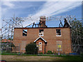
Upper Abbey Farm - 9 months on
See Image] and Image], particularly the latter, to get the background. Home to one family (mine) for over 120 years, it was then sold, and let out. It suffered a catastrophic fire in December 2009, reportedly started in an upstairs room by papers ignited by an overheating laptop. The seat of the fire must have been in or close to the room where I was born - top left in this image - the brick gable end above has been completely destroyed. For the family living there at the time it was undoubtedly a devastating tragedy - for the house itself, too. The central staircase, fine for a mere farmhouse, is presumably lost completely. It is some consolation that, despite lack of insurance, the new owners are starting the reconstruction process.
Image: © Zorba the Geek
Taken: 6 Sep 2010
0.04 miles
8
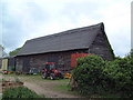
Upper Abbey Barn
The substantial thatched roof of this barn is in particularly good repair.
Image: © David Squire
Taken: 21 May 2006
0.04 miles
9
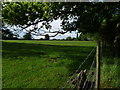
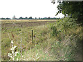
While you can (10): Upper Abbey "Front Meadow"
A series of images of places likely to change when Sizewell C Nuclear Power Station is built. This meadow south of Upper Abbey Farm used to be known as "The Front Meadow" and is currently (May 2014) the undisturbed habitat for many rabbits. It is also the site of the proposed access road to Sizewell C power station, which will cross it from west to east across this view.
Image: © Zorba the Geek
Taken: 22 May 2014
0.13 miles