IMAGES TAKEN NEAR TO
Thorpe Road, LEISTON, IP16 4QX
Introduction
This page details the photographs taken nearby to Thorpe Road, IP16 4QX by members of the Geograph project.
The Geograph project started in 2005 with the aim of publishing, organising and preserving representative images for every square kilometre of Great Britain, Ireland and the Isle of Man.

There are currently over 7.5m images from over14,400 individuals and you can help contribute to the project by visiting https://www.geograph.org.uk
Image Map
Images are licensed for reuse under creativecommons.org/licenses/by-sa/2.0
Notes
- Clicking on the map will re-center to the selected point.
- The higher the marker number, the further away the image location is from the centre of the postcode.
Image Listing (32 Images Found)
Images are licensed for reuse under creativecommons.org/licenses/by-sa/2.0
Image
Details
Distance
1
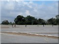
Agricultural workers, Aldringham
The crop is covered by a fine mesh.
Image: © Bikeboy
Taken: 26 Aug 2014
0.02 miles
3
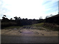
Footpath to the B1122 Aldeburgh Road
Off the B1353 Aldringham Lane
Image: © Geographer
Taken: 7 Mar 2014
0.02 miles
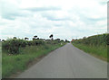
4
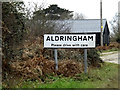
Entering Ardringham on the B1353 Aldringham Lane
Image: © Geographer
Taken: 27 Jan 2015
0.03 miles
5
Ardringham Village Name sign
On the B1353 Aldringham Lane
Image: © Geographer
Taken: 27 Jan 2015
0.03 miles
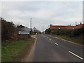
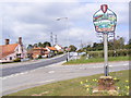
6
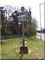
Aldringham Village Sign
On the B1122 Aldeburgh Road at the junction with the B1353 Thorpeness Road
Image: © Geographer
Taken: 26 Apr 2010
0.14 miles
7
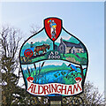
Aldringham village sign
The sign is surmounted by a depiction of Sir Ranulph de Glanville founder of Leiston abbey, and Aldringham church was under the care of the abbey. A farmer in his cart is representing the agricultural heritage of the village and the lovely church of St Andrew in the adjacent panel. The lower image shows the Hundred River with bulrushes and a kingfisher. The village of Thorpeness is part of Aldringham but has its own village sign. https://www.geograph.org.uk/photo/6776195
Image: © Adrian S Pye
Taken: 22 Apr 2021
0.16 miles
8
Aldringham Village Sign
On the B1122 Aldeburgh Road at the junction with the B1353 Thorpeness Road
(Close up)
Image: © Geographer
Taken: 26 Apr 2010
0.16 miles
9
Aldringham Village Sign & B1122 Aldeburgh Road
Looking towards Leiston at the junction with the B1353 Thorpeness Road.
Image: © Geographer
Taken: 26 Apr 2010
0.16 miles
10
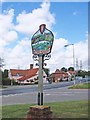
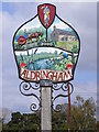
Aldringham village sign
The sign is surmounted by a depiction of Sir Ranulph de Glanville founder of Leiston abbey and Aldringham church was under the care of the abbey. A farmer in his cart is representing the agricultural heritage of the village and the lovely church of St Andrew in the adjacent panel. The lower image shows the Hundred River with bulrushes and a kingfisher. The village of Thorpeness is part of Aldringham but has its own village sign.
Image: © Adrian S Pye
Taken: 14 Aug 2008
0.16 miles