
IMAGES TAKEN NEAR TO
Shellpit Cottages, LEISTON, IP16 4PG
Introduction
This page details the photographs taken nearby to Shellpit Cottages, IP16 4PG by members of the Geograph project.
The Geograph project started in 2005 with the aim of publishing, organising and preserving representative images for every square kilometre of Great Britain, Ireland and the Isle of Man.

There are currently over 7.5m images from over14,400 individuals and you can help contribute to the project by visiting https://www.geograph.org.uk
Image Map
Images are licensed for reuse under creativecommons.org/licenses/by-sa/2.0
Notes
- Clicking on the map will re-center to the selected point.
- The higher the marker number, the further away the image location is from the centre of the postcode.
Image Listing (20 Images Found)
Images are licensed for reuse under creativecommons.org/licenses/by-sa/2.0
Image
Details
Distance
1

Footpath through silver birch in Margaret Wood
The path leads to Thorpeness from Sandlings Walk
Image: © David Smith
Taken: 18 Jun 2014
0.05 miles
2
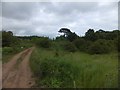
Sandlings Walk and moorland, Thorpeness
On the skyline is the chimney of one of the cottages, Shellpits Cottages
Image: © David Smith
Taken: 18 Jun 2014
0.06 miles
3

Footpath to Thorpeness near Shellpits Cottages
Image: © David Smith
Taken: 18 Jun 2014
0.07 miles

6

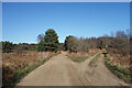
Gateway from Sandlings Walk to The Walks
The track gives access to the moorland area known as The Walks
Image: © David Smith
Taken: 18 Jun 2014
0.08 miles
7

Sandlings Walk entering woodland at Shellpits Cottages
Image: © David Smith
Taken: 18 Jun 2014
0.08 miles
8

Gate to Corporals Belts
Nothing to do with military trousers, Corporals Belts is the name on the map for this bit of wooded heathland. It is a conservation area.
Image: © Des Blenkinsopp
Taken: 19 Mar 2022
0.09 miles
9

Footpath in The Walks, north-west of Thorpeness
A path which leads off the Sandlings Walk, near Shellpits Cottages
Image: © David Smith
Taken: 18 Jun 2014
0.09 miles
10

Heathland track on The Walks, Aldringham Common
Looking north-west along the edge of the conifer plantation called Corporals' Belts, established after the First World War.
Image: © Simon Mortimer
Taken: 7 Apr 2025
0.10 miles