1
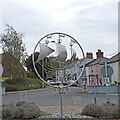
The Railway Inn pub sign, Aldeburgh
Image: © Adrian S Pye
Taken: 26 Feb 2011
0.02 miles
2
The Railway public house at Aldeburgh
Image: © Adrian S Pye
Taken: 26 Feb 2011
0.02 miles
3
B1122 Leiston Road, Aldeburgh
Near The Railway Inn Public House at the junction with the A1094 Saxmundham Road, A1094 Victoria Road & Church Farm Road
Image: © Geographer
Taken: 3 Feb 2015
0.02 miles
4
The Railway Inn, formerly Station Hotel, Aldeburgh
The public house was constructed next door to the now-demolished Aldeburgh railway station in the early 1860s.
Image: © Simon Mortimer
Taken: 13 Apr 2022
0.03 miles
5
The Railway Public Inn House, Aldeburgh
Off the B1122 Leiston Road at the junction with the A1094 Saxmundham Road, A1094 Victoria Road & Church Farm Road
Image: © Geographer
Taken: 3 Feb 2015
0.03 miles
6
The Railway Public Inn House sign
Off the B1122 Leiston Road At the junction with the A1094 Saxmundham Road, A1094 Victoria Road & Church Farm Road
Image: © Geographer
Taken: 3 Feb 2015
0.03 miles
7
The Railway Inn, Aldeburgh
An Adnams pub. The railway station used to be to the right (east).
Image: © Ian Taylor
Taken: 27 Jun 2013
0.03 miles
8
The Railway Public House, Aldeburgh
At the junction with the A1094 Saxmundham Road, A1094 Victoria Road & B1122 Leiston Road
Image: © Geographer
Taken: 3 Feb 2015
0.03 miles
9
Saxmundham Road, Aldeburgh
Image: © David Dixon
Taken: 4 Aug 2013
0.05 miles
10
Aldeburgh town sign
The fine sign is almost obscured amongst a plethora of road signs on the roundabout upon which it is located. An extra two feet on the support pole would help make it a bit more noticeable.
The sign is based upon a seal granted to the Borough in 1561. The emblems are appropriate for an ancient port, fishing and shipbuilding centre.
https://www.geograph.org.uk/photo/6636210.
Image: © Adrian S Pye
Taken: 12 Oct 2020
0.05 miles


