
IMAGES TAKEN NEAR TO
Victoria Road, ALDEBURGH, IP15 5EJ
Introduction
This page details the photographs taken nearby to Victoria Road, IP15 5EJ by members of the Geograph project.
The Geograph project started in 2005 with the aim of publishing, organising and preserving representative images for every square kilometre of Great Britain, Ireland and the Isle of Man.

There are currently over 7.5m images from over14,400 individuals and you can help contribute to the project by visiting https://www.geograph.org.uk
Image Map
Images are licensed for reuse under creativecommons.org/licenses/by-sa/2.0
Notes
- Clicking on the map will re-center to the selected point.
- The higher the marker number, the further away the image location is from the centre of the postcode.
Image Listing (82 Images Found)
Images are licensed for reuse under creativecommons.org/licenses/by-sa/2.0
Image
Details
Distance
1
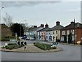
Roundabout and houses, Victoria Road, Aldeburgh
The houses were constructed opposite Aldeburgh Railway Station which opened in 1860 and closed in 1966. The roundabout sits on the site of the station buildings which were cleared in 1975.
Image: © Simon Mortimer
Taken: 13 Apr 2022
0.00 miles
2
A1094 Victoria Road, Aldeburgh
At the junction with the A1094 Saxmundham Road & B1122 Leiston Road
Image: © Geographer
Taken: 3 Feb 2015
0.01 miles
3
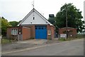
Aldeburgh fire station
Aldeburgh fire station, Kings Field, Aldeburgh, Suffolk
Image: © Kevin Hale
Taken: 5 Jun 2010
0.02 miles
4
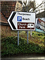
Roadsign on Church Farm Road
At the junction with the B1122 Leiston Road, A1094 Saxmundham Road & A1094 Victoria Road
Image: © Geographer
Taken: 3 Feb 2015
0.02 miles
5
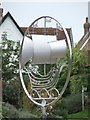
Ship artwork
Artwork on roundabout Aldeburgh Suffolk for overall view see http://www.geograph.org.uk/photo/940028
Image: © Keith Evans
Taken: 28 Aug 2008
0.02 miles
6
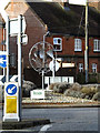
Aldeburgh sign on the roundabout
At the junction with the A1094 Saxmundham Road, A1094 Victoria Road & B1122 Leiston Road
Image: © Geographer
Taken: 3 Feb 2015
0.02 miles
7
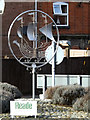
Aldeburgh sign on the roundabout
At the junction with the A1094 Saxmundham Road, A1094 Victoria Road & B1122 Leiston Road
(Close up)
Image: © Geographer
Taken: 3 Feb 2015
0.02 miles
8
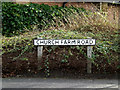
Church Farm Road sign
On Church Farm Road at the junction with the B1122 Leiston Road, A1094 Saxmundham Road & A1094 Victoria Road
Image: © Geographer
Taken: 3 Feb 2015
0.02 miles
9
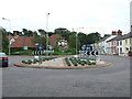
Public artwork
Public artwork on roundabout Aldeburgh Suffolk for close up see http://www.geograph.org.uk/photo/940022
This is the site of Aldeburgh Railway station, opened in the 1860's and closed in 1966.
http://www.subbrit.org.uk/sb-sites/stations/a/aldeburgh/index.shtml
Image: © Keith Evans
Taken: 28 Aug 2008
0.02 miles
10

Roundabout, Aldeburgh
Note the vegetation growth since Keith Evans' 2008 photo Image
See Image for a close view of the galleon.
Image: © Ian Taylor
Taken: 27 Jun 2013
0.02 miles