1
Aldeburgh Telephone Exchange
Located at 18 Alde Lane IP15 5DZ, this TE appears to date from the late 1960s or early 1970s, being of a standard design. It serves Aldeburgh plus Thorpeness nearby and has (01728) 45xxxx numbers, the (01728) referring to the Saxmundham group of TEs. A sycamore tree can be seen in front of the TE with the street name "Granvilles Garden" adjacent to it. Also, a Cross Roads triangular road sign is hidden by the tree. Hopefully, the tree roots won't get in the way of the underground cables that are connected to the TE.
Image: © David Hillas
Taken: 16 Jul 2013
0.07 miles
2
"Uplands", Aldeburgh
No longer an hotel. In fact, the premises have gone full circle from 19th century private home to guest house to hotel and, now, back to private accommodation. The conservatory is a 20th century addition.
The house has had some illustrious residents: in the 1850s, Elizabeth Garrett Anderson - first woman doctor and first female mayor; in the 1900s, prominent suffragette Millicent Fawcett (neé Garrett); and it has also been associated with poet George Crabbe.
Latterly, it was popular with visitors and musicians attending the annual Aldeburgh Festival.
Image: © Anthony O'Neil
Taken: Unknown
0.08 miles
3
A1094 Victoria Road, Aldeburgh
At the junction with Church Close near St.Peter & St.Paul Church
Image: © Geographer
Taken: 27 Jan 2015
0.09 miles
4
Church Close, Aldeburgh
At the junction with the A1094 Victoria Road near St.Peter & St.Paul Church
Image: © Geographer
Taken: 27 Jan 2015
0.09 miles
5
Aldeburgh, Victoria Road (A1094)
Image: © David Dixon
Taken: 4 Aug 2013
0.09 miles
6
St.Peter & St. Paul's Church sign
Off the A1094 Victoria Road
Image: © Geographer
Taken: 27 Jan 2015
0.09 miles
7
A1094 Victoria Road, Aldeburgh
At the junction with Church Close near St.Peter & St.Paul Church
Image: © Geographer
Taken: 27 Jan 2015
0.09 miles
8
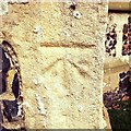
Cut Mark Aldeburgh St Peter and St Pauls Church???
Cut Mark Aldeburgh St Peter and St Pauls Church (Tower) SW buttress.
Image: © Cud05
Taken: 24 Mar 2016
0.10 miles
9
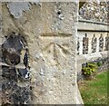
Aldeburgh, St Peter's and St Paul's church
The benchmark is cut into the south-west buttress of the church tower.
Image: © Mel Towler
Taken: 3 Jul 2022
0.10 miles
10
Victoria Road past the church of SS Peter & Paul
Image: © Helen Steed
Taken: 27 Aug 2012
0.10 miles


