
IMAGES TAKEN NEAR TO
Church Walk, ALDEBURGH, IP15 5DU
Introduction
This page details the photographs taken nearby to Church Walk, IP15 5DU by members of the Geograph project.
The Geograph project started in 2005 with the aim of publishing, organising and preserving representative images for every square kilometre of Great Britain, Ireland and the Isle of Man.

There are currently over 7.5m images from over14,400 individuals and you can help contribute to the project by visiting https://www.geograph.org.uk
Image Map
Images are licensed for reuse under creativecommons.org/licenses/by-sa/2.0
Notes
- Clicking on the map will re-center to the selected point.
- The higher the marker number, the further away the image location is from the centre of the postcode.
Image Listing (651 Images Found)
Images are licensed for reuse under creativecommons.org/licenses/by-sa/2.0
Image
Details
Distance
1
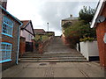
Path up to Church Walk
It starts at High Street.
Image: © Hamish Griffin
Taken: 21 Sep 2014
0.04 miles
2
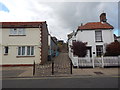
Path up to Church Walk
From High Street (A1094) which can be seen below.
Image: © Hamish Griffin
Taken: 21 Sep 2014
0.05 miles
3
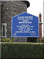
Our Lady and St. Peter Catholic Church sign
Off The Terrace
Image: © Geographer
Taken: 3 Feb 2015
0.05 miles
4
![Aldeburgh houses [10]](https://s3.geograph.org.uk/geophotos/06/73/02/6730251_17f27eac_120x120.jpg)
Aldeburgh houses [10]
Cherry Cottage, number 13 Town Steps is set gable end to the steps. Built circa 1820 in brick. Listed, grade II, with details at: https://historicengland.org.uk/listing/the-list/list-entry/1269727
Aldeburgh is a coastal town, some 20 miles north east of Ipswich and 23 miles south of Lowestoft. Although there are traces of Roman and Saxon occupation, Aldeburgh was a little fishing village until the shifting coastline opened up a sheltered harbour which became a thriving ship building centre. As the River Alde silted up the town’s fortunes waned, and it survived as a fishing village until the 19th Century when it became a fashionable seaside resort. A classical music festival takes place at nearby Snape Maltings each year.
Image: © Michael Dibb
Taken: 10 Sep 2020
0.05 miles
5
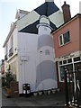
Lighthouse painted on 77 High Street, Aldeburgh
A cut bench mark (see http://www.geograph.org.uk/photo/2555765 ) is close to the litter bin.
Image: © Brian Westlake
Taken: 21 May 2011
0.05 miles
6
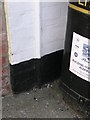
Cut Mark: Aldeburgh, 77 High St
Only the datum cut is clear to see on the end wall of a restaurant (see http://www.geograph.org.uk/photo/2555757 ). See http://www.bench-marks.org.uk/bm27214 for bench mark details.
Image: © Brian Westlake
Taken: 21 May 2011
0.05 miles
7
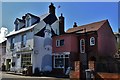
Aldeburgh High Street: The Lighthouse Restaurant
Image: © Michael Garlick
Taken: 22 Mar 2016
0.05 miles
8
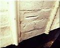
Cut Mark Aldeburgh 77 High Street
Cut Mark Aldeburgh 77 High Street, NE angle, N face.
Image: © Cud05
Taken: 24 Mar 2016
0.05 miles
9
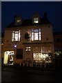
A festive restaurant on the High Street
Image: © Basher Eyre
Taken: 30 Dec 2016
0.05 miles
10
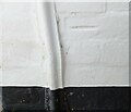
Aldeburgh, 77 High Street
The benchmark is cut into the north facing wall of the property. The mark has been damaged from thick masonry paint, and only the horizontal datum line can be seen easily.
Image: © Mel Towler
Taken: 3 Jul 2022
0.05 miles