
IMAGES TAKEN NEAR TO
Wentworth Road, ALDEBURGH, IP15 5BE
Introduction
This page details the photographs taken nearby to Wentworth Road, IP15 5BE by members of the Geograph project.
The Geograph project started in 2005 with the aim of publishing, organising and preserving representative images for every square kilometre of Great Britain, Ireland and the Isle of Man.

There are currently over 7.5m images from over14,400 individuals and you can help contribute to the project by visiting https://www.geograph.org.uk
Image Map
Images are licensed for reuse under creativecommons.org/licenses/by-sa/2.0
Notes
- Clicking on the map will re-center to the selected point.
- The higher the marker number, the further away the image location is from the centre of the postcode.
Image Listing (543 Images Found)
Images are licensed for reuse under creativecommons.org/licenses/by-sa/2.0
Image
Details
Distance
1
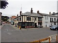
Aldeburgh - 2013
Aldeburgh, Suffolk, Market Cross Place, 'Mill Inn'
Image: © Helmut Zozmann
Taken: 16 Aug 2013
0.01 miles
2
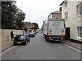
Aldeburgh - 2013
Aldeburgh, Suffolk, Wentworth Road
Image: © Helmut Zozmann
Taken: 16 Aug 2013
0.01 miles
3
![Aldeburgh houses [4]](https://s1.geograph.org.uk/geophotos/06/73/02/6730229_b0f02e2e_120x120.jpg)
Aldeburgh houses [4]
Market Cross House, number 17 Market Cross Place was built, in brick, circa 1860. The building later became a hotel and is now three flats, converted in the late 20th century. There is a continuous first floor balcony carried on the bay windows and the porch. Listed, grade II, with details at: https://historicengland.org.uk/listing/the-list/list-entry/1269714
Aldeburgh is a coastal town, some 20 miles north east of Ipswich and 23 miles south of Lowestoft. Although there are traces of Roman and Saxon occupation, Aldeburgh was a little fishing village until the shifting coastline opened up a sheltered harbour which became a thriving ship building centre. As the River Alde silted up the town’s fortunes waned, and it survived as a fishing village until the 19th Century when it became a fashionable seaside resort. A classical music festival takes place at nearby Snape Maltings each year.
Image: © Michael Dibb
Taken: 10 Sep 2020
0.01 miles
4
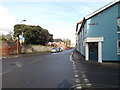
Wentworth Road, Aldeburgh
At the junction with the A1094 High Street & A1094 Victoria Road
Image: © Geographer
Taken: 3 Feb 2015
0.02 miles
5

The Mill Inn, Aldeburgh
https://www.geograph.org.uk/photo/6200633
https://www.geograph.org.uk/photo/6200636
Image: © Adrian S Pye
Taken: 30 Apr 2015
0.02 miles
6

Sign of The Mill Inn, Aldeburgh (2)
There are two hanging signs to
https://www.geograph.org.uk/photo/6200631
https://www.geograph.org.uk/photo/6200633
Image: © Adrian S Pye
Taken: 30 Apr 2015
0.02 miles
7
![Aldeburgh houses [5]](https://s3.geograph.org.uk/geophotos/06/73/02/6730235_9f8c3daa_120x120.jpg)
Aldeburgh houses [5]
Moot House, number 18 Market Cross Place, was built, in brick, now rendered and painted, circa 1840. The house has been altered in the 20th century. There is a continuous cantilevered first floor balcony. Listed, grade II, with details at: https://historicengland.org.uk/listing/the-list/list-entry/1269715
Aldeburgh is a coastal town, some 20 miles north east of Ipswich and 23 miles south of Lowestoft. Although there are traces of Roman and Saxon occupation, Aldeburgh was a little fishing village until the shifting coastline opened up a sheltered harbour which became a thriving ship building centre. As the River Alde silted up the town’s fortunes waned, and it survived as a fishing village until the 19th Century when it became a fashionable seaside resort. A classical music festival takes place at nearby Snape Maltings each year.
Image: © Michael Dibb
Taken: 10 Sep 2020
0.02 miles
8
![Aldeburgh buildings [6]](https://s2.geograph.org.uk/geophotos/06/72/94/6729446_67f53e39_120x120.jpg)
Aldeburgh buildings [6]
The White Lion Hotel in Market Cross Place, consists of an inn and two houses. The inn to the right was built in brick in the 17th century and was refronted circa 1840. In the late 19th century the hotel expanded into the central block, a brick built house of the mid 19th century. In the 20th century further expansion took the hotel into the 1820s brick built house on the left. A number of original internal fittings remain. Listed, grade II, with details at: https://historicengland.org.uk/listing/the-list/list-entry/1269713
Aldeburgh is a coastal town, some 20 miles north east of Ipswich and 23 miles south of Lowestoft. Although there are traces of Roman and Saxon occupation, Aldeburgh was a little fishing village until the shifting coastline opened up a sheltered harbour which became a thriving ship building centre. As the River Alde silted up the town’s fortunes waned, and it survived as a fishing village until the 19th Century when it became a fashionable seaside resort. A classical music festival takes place at nearby Snape Maltings each year.
Image: © Michael Dibb
Taken: 10 Sep 2020
0.02 miles
10
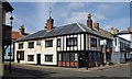
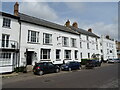
"The Mill Inn", Aldeburgh
Grade II listed public house, described at this http://list.historicengland.org.uk/resultsingle.aspx?uid=1269694.
Image: © Jim Osley
Taken: 2 Apr 2015
0.02 miles